
Statistics Canada
www.statcan.gc.ca
Common menu bar links
Chart 2.2
Trends in water yield for Southern Canada, 1971 to 2004

Archived Content
Information identified as archived is provided for reference, research or recordkeeping purposes. It is not subject to the Government of Canada Web Standards and has not been altered or updated since it was archived. Please "contact us" to request a format other than those available.
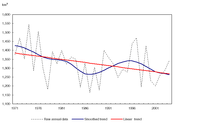
Note(s): Southern Canada in delineated by the North-line which separates Canada
into two regions based on 16 social, biotic, economic and climatic
variables (Map 2.3).
Source(s): McNiven C., and H. Puderer, 2000, "Delineation of Canada's North:
An Examination of the North-South Relationship in Canada", Geography working
Paper Series, Statistics Canada Catalogue no. 92F0138M2000003. Statistics Canada, Environment Accounts and Statistics Division
and Business Survey Methodology Division, 2010, special tabulation.