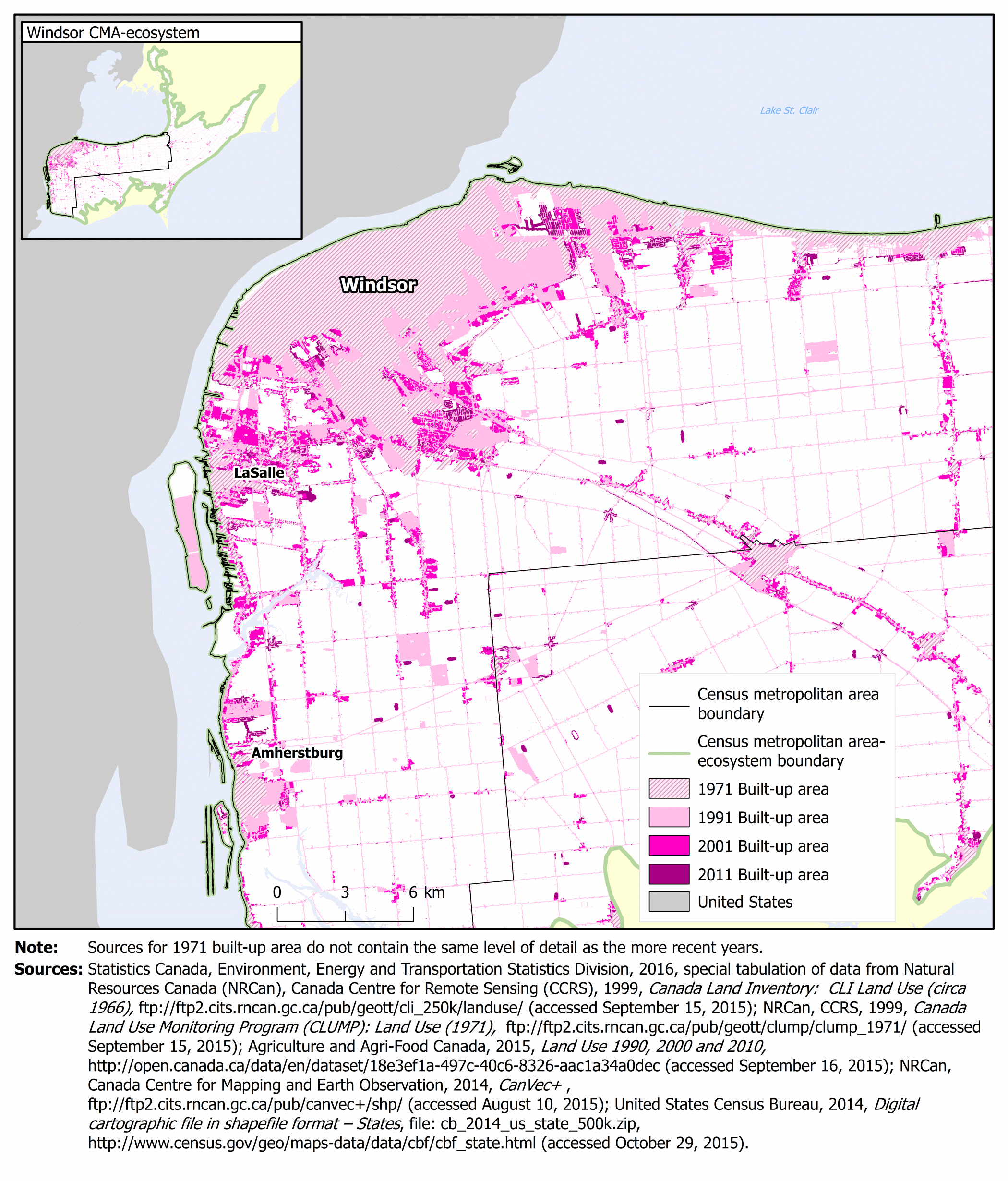
Map 3.33
Built-up area, Windsor census metropolitan area (CMA) and census metropolitan area-ecosystem (CMA-E), 1971, 1991, 2001 and 2011

Description of Map 3.33
The title of this map is Built-up area, Windsor census metropolitan area (CMA) and census metropolitan area-ecosystem (CMA-E), 1971, 1991, 2001 and 2011. This map has two main components—a large map zoomed into the main CMA built-up area and an inset map locating the built-up area with respect to the boundaries for the full CMA and CMA-E.
On this map, pale pink with dark pink diagonal lines represents 1971 built-up area, light pink represents 1991 built-up area, medium pink represents 2001 built-up area and dark pink is used to represent 2011 built-up area. Census metropolitan area-ecosystem boundaries are represented by a green line, census metropolitan area boundaries are represented by a black line. Some place names are included on the map. Land areas outside of the census metropolitan area-ecosystem are coloured pale yellow and areas within the United States are coloured pale grey.
In Windsor, most expansion of built-up area from 1971 to 2011 occurred in the areas adjacent to the 1971 built-up area and LaSalle. However, pockets of new development also occurred in other areas.
Note: Sources for 1971 built-up area do not contain the same level of detail as the more recent years.
Sources: Statistics Canada, Environment, Energy and Transportation Statistics Division, 2016, special tabulation of data from Natural Resources Canada (NRCan), Canada Centre for Remote Sensing (CCRS), 1999, Canada Land Inventory: CLI Land Use (circa 1966), ftp://ftp2.cits.rncan.gc.ca/pub/geott/cli_250k/landuse/ (accessed September 15, 2015); NRCan, CCRS, 1999, Canada Land Use Monitoring Program (CLUMP): Land Use (1971),
ftp://ftp2.cits.rncan.gc.ca/pub/geott/clump/clump_1971/ (accessed September 15, 2015); Agriculture and Agri-Food Canada, 2015, Land Use 1990, 2000 and 2010, http://open.canada.ca/data/en/dataset/18e3ef1a-497c-40c6-8326-aac1a34a0dec (accessed September 16, 2015); NRCan, Canada Centre for Mapping and Earth Observation, 2014, CanVec+,
ftp://ftp2.cits.rncan.gc.ca/pub/canvec+/shp/ (accessed August 10, 2015); United States Census Bureau, 2014, Digital cartographic file in shapefile format — States, File: cb_2014_us_state_500k.zip, http://www.census.gov/geo/maps-data/data/cbf/cbf_state.html (accessed October 29, 2015).
Download spatial data files (ArcGIS®, file extension: .shp) for Windsor
- Date modified: