
Figure 1
Freshwater in Canada: A look at Canada's freshwater resources from 1971 to 2013
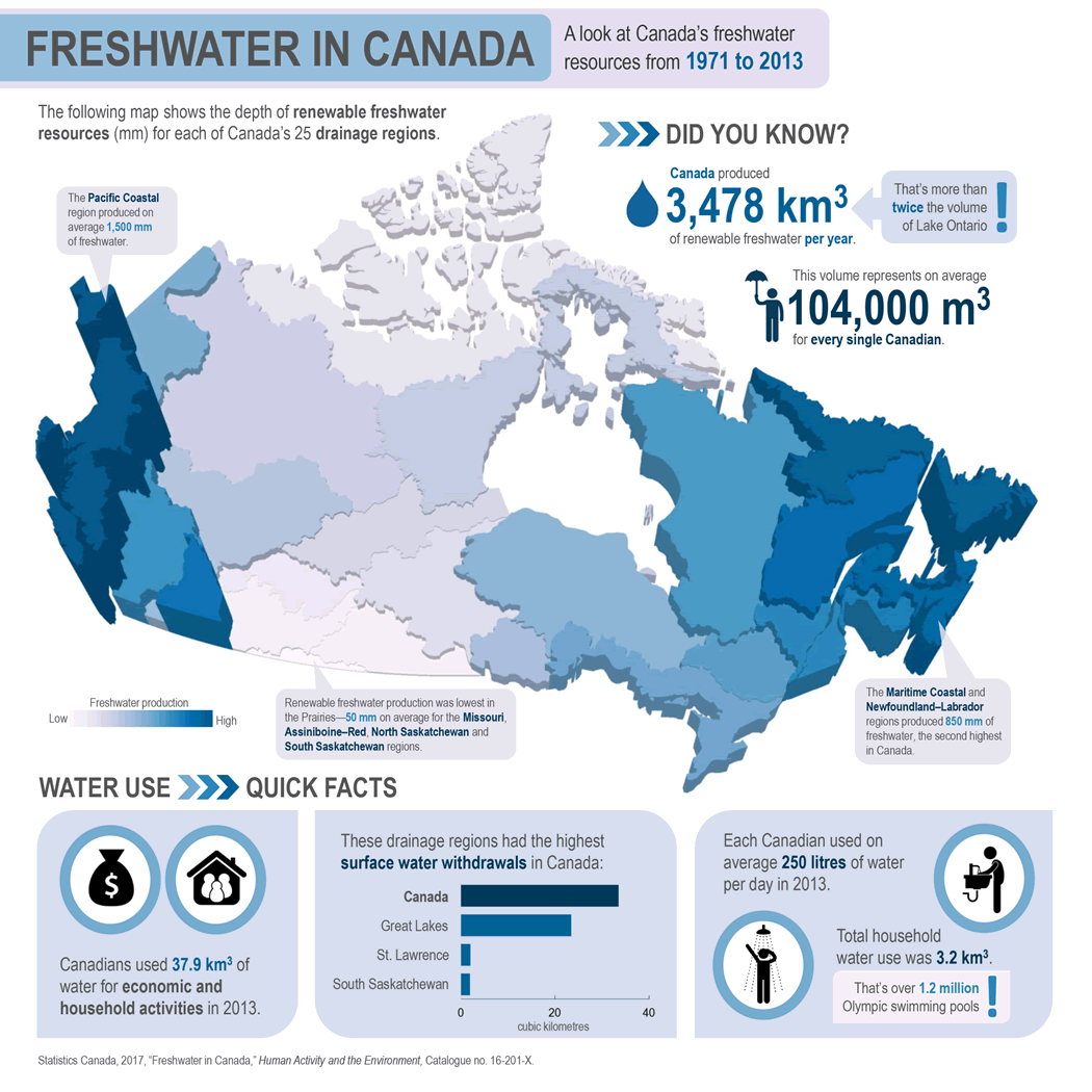
Description for Figure 1
The title of the infographic is "Freshwater in Canada: A look at Canada's freshwater resources from 1971 to 2013."
It displays a 3D map with the height of each drainage region indicating depth of renewable freshwater production. A legend indicates that the darker the blue, the more renewable freshwater was produced. Short statements are provided for drainage regions of note, indicated with leader lines. The infographic also includes a bar chart with on surface water withdrawals, several pictographs and facts about renewable freshwater and water use.
Text on the infographic and bar chart data are as follows:
The following map shows the depth of renewable freshwater resources (mm) for each of Canada's 25 drainage regions.
The Pacific Coastal region produced on average 1500 mm of freshwater.
Renewable freshwater production was lowest in the Prairies—50 mm on average for the Missouri, Assiniboine–Red, North Saskatchewan and South Saskatchewan regions.
The Maritime Coastal and Newfoundland–Labrador regions produced 850 mm of freshwater, the second highest in Canada.
DID YOU KNOW?
Canada produced 3,478 km3 of renewable freshwater per year. That's more than twice the volume of Lake Ontario!
WATER USE QUICK FACTS
Canadians used 37.9 km3 of water for economic and household activities in 2013.
These drainage had the highest surface water withdrawals in Canada: Canada (33.5 km3), Great Lakes (23.5 km3), St. Lawrence (2.0 km3), South Saskatchewan (1.9 km3).
Each Canadian used on average 250 litres of water per day in 2013. Total household water use was 3.2 km3. That's over 1.2 million Olympic swimming pools.
Statistics Canada, 2017, "Freshwater in Canada," Human Activity and the Environment, Catalogue no. 16-201-X.
- Date modified: