
Map 1.1
Drainage regions of Canada
Download spatial data files (ArcGIS®, file extension: .shp) for Map 1.1
Description for Map 1.1
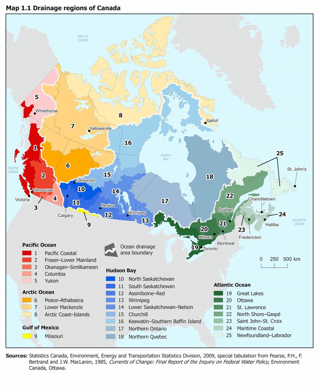
The title of this map is “Drainage regions of Canada.” This map outlines the boundaries of the 25 drainage regions in Canada and the 5 ocean drainage areas. These drainage regions cover all of the area within the coastal boundaries of Canada.
On this map, a black line defines provincial and international boundaries while a thicker white line defines an ocean drainage area boundary and a grey line defines the drainage region boundary. Each drainage region is identified with a unique number and colour.
Drainage regions in the Pacific Ocean drainage area are in the red colour spectrum; regions draining into the Arctic Ocean are in the orange spectrum; the single region draining into the Gulf of Mexico is yellow; regions draining into Hudson Bay are in a blue-grey palette and regions draining into the Atlantic Ocean are in the green spectrum.
The locations and names of some major cities in each province and territory are included on the map. Land areas outside of Canada are coloured light grey. Water is pale blue and major bodies, like oceans and bays, are named.
Sources: Statistics Canada, Environment, Energy and Transportation Statistics Division, 2009, special tabulation data from Pearse, P.H., F. Bertrand and J.W. MacLaren, 1985, Currents of Change: Final Report of the Inquiry on Federal Water Policy, Environment Canada, Ottawa.
| Ocean drainage areas and drainage regions | Code |
|---|---|
| Pacific Ocean | |
| Pacific Coastal | 1 |
| Fraser–Lower Mainland | 2 |
| Okanagan–Similkameen | 3 |
| Columbia | 4 |
| Yukon | 5 |
| Arctic Ocean | |
| Peace–Athabasca | 6 |
| Lower Mackenzie | 7 |
| Arctic Coast–Islands | 8 |
| Gulf of Mexico | |
| Missouri | 9 |
| Hudson Bay | |
| North Saskatchewan | 10 |
| South Saskatchewan | 11 |
| Assiniboine–Red | 12 |
| Winnipeg | 13 |
| Lower Saskatchewan–Nelson | 14 |
| Churchill | 15 |
| Keewatin–Southern Baffin Island | 16 |
| Northern Ontario | 17 |
| Northern Quebec | 18 |
| Atlantic Ocean | |
| Great Lakes | 19 |
| Ottawa | 20 |
| St. Lawrence | 21 |
| North Shore–Gaspé | 22 |
| Saint John–St. Croix | 23 |
| Maritime Coastal | 24 |
| Newfoundland–Labrador | 25 |
- Date modified: