
Health Regions: Boundaries and Correspondence with Census Geography
Map 1 Newfoundland and Labrador Health Regions, 2015
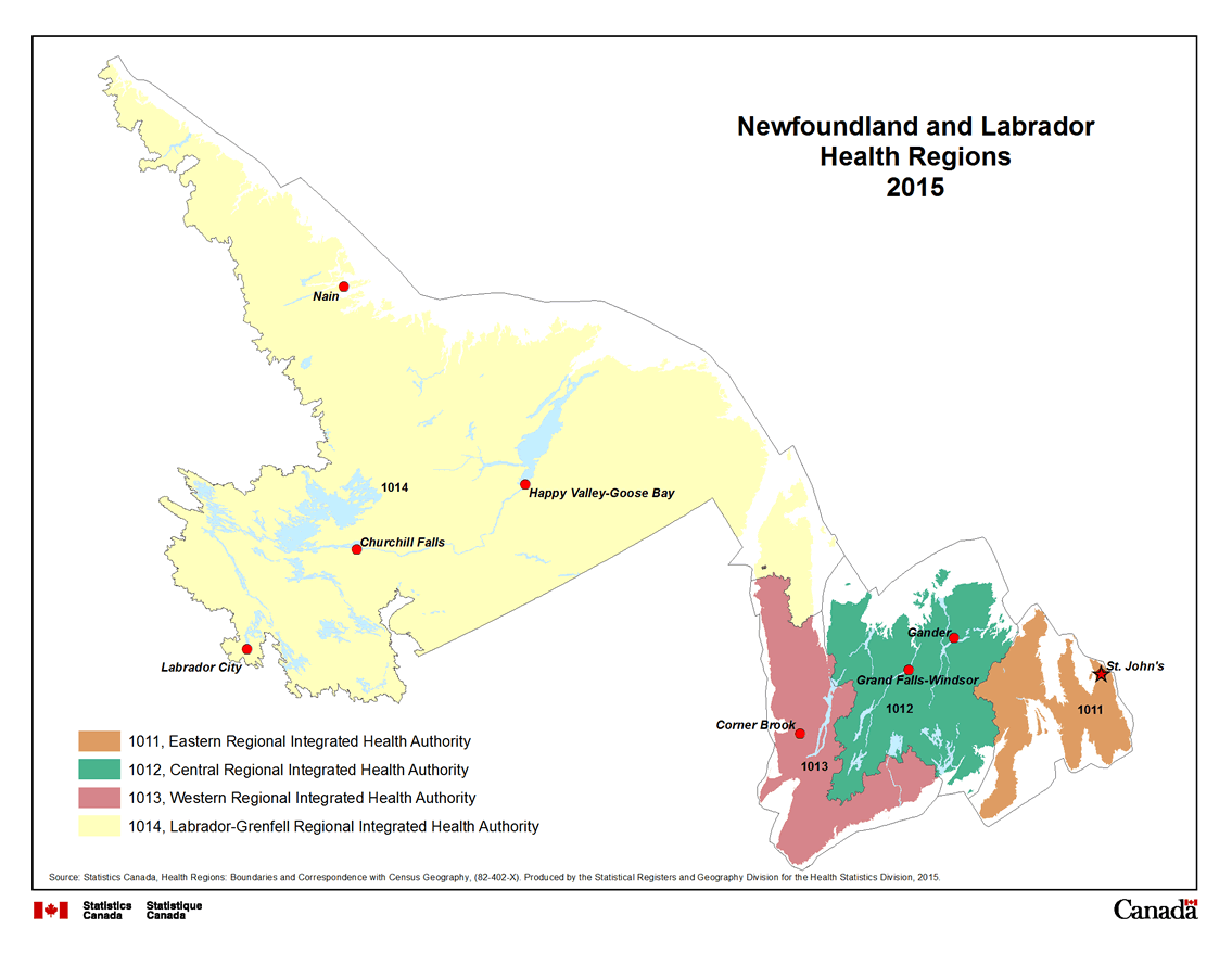
Description for Map 1
This map shows the four Regional Integrated Health Authorities in Newfoundland and Labrador. Eastern Regional Integrated Health Authority, code 1011, is coloured orange. Central Regional Integrated Health Authority, code 1012, is coloured green. Western Regional Integrated Health Authority, code 1013, is coloured brown. Labrador-Grenfell Regional Integrated Health Authority, code 1014, is coloured yellow.
Regional Integrated Health Authorities are outlined by a thin black line and labeled in black text with their four digit health region code.
Water features are displayed on the map for reference purposes. Linear water features appear on the map as a thin blue line while water bodies are shaded blue. Some cities are labeled in black text, for reference purposes.
Source: Statistics Canada, Health Regions: Boundaries and Correspondence with Census Geography, (82-402-X). Produced by the Statistical Registers and Geography Division for the Health Statistics Division, 2015.
- Date modified: