
Health Regions: Boundaries and Correspondence with Census Geography
Map 6 Ontario, Health Units – Northern Ontario Health Regions, 2015
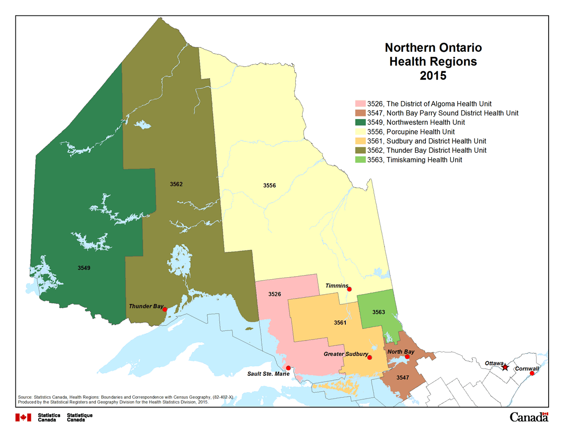
Description for Map 6
This map shows the seven Public Health Units in Northern Ontario. The District of Algoma Health Unit, code 3526, is coloured pink. North Bay Parry Sound District Health Unit, code 3547, is coloured brown. Northwestern Health Unit, code 3549, is coloured purple. Porcupine Health Unit, code 3556, is coloured yellow. Sudbury and District Health Unit, code 3561, is coloured orange. Thunder Bay District Health Unit, code 3562, is coloured dark brown. Timiskaming Health Unit, code 3563, is coloured green.
Public Health Units are outlined by a thin black line and labeled in black text with their four digit health region code.
Water features are displayed on the map for reference purposes. Linear water features appear on the map as a thin blue line while water bodies are shaded blue. Some cities are labeled in black text, for reference purposes.
Source: Statistics Canada, Health Regions: Boundaries and Correspondence with Census Geography, (82-402-X). Produced by the Statistical Registers and Geography Division for the Health Statistics Division, 2015.
- Date modified: