Overview
Archived Content
Information identified as archived is provided for reference, research or recordkeeping purposes. It is not subject to the Government of Canada Web Standards and has not been altered or updated since it was archived. Please "contact us" to request a format other than those available.
The Census Agricultural Regions Boundary Files
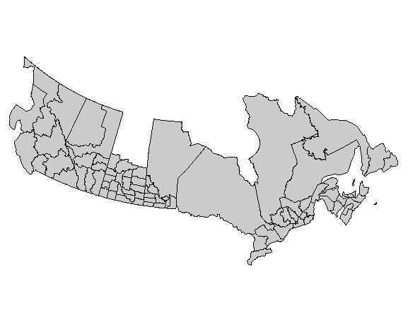
The 2006 Census Agricultural Regions Boundary Files contain the boundaries of all 82 census agricultural regions (see the Glossary subsection for a definition) delineated for the 2006 Census of Agriculture.
The 2006 Census Agricultural Regions Boundary Files are available for download in two types: digital boundary file and cartographic boundary file.
The 2006 Census Agricultural Regions Boundary Files provide a framework for mapping and spatial analysis. The digital file depicts the full extent of the geographical areas, including the coastal water area. See Figure 2.1. The cartographic file depicts the geographical areas using only the major land mass of Canada and its coastal islands. See Figure 2.2. The files are available in three formats: ArcInfo® (.shp), MapInfo® (.tab) and Geography Markup Language (.gml).
Supplementary hydrographic layers are also available and provided by Geography Division. More details can be found in the Boundary Files Reference Guide 2006 Census, Catalogue No. 92-160-GIE. This 'water' layer can be used for additional reference purposes when mapping or displaying the boundaries in either the digital or cartographic boundary file.
Figure 2.1 Census Agricultural Regions Digital Boundary File, 2006

Figure 2.2 Census Agricultural Regions Cartographic Boundary File with coastline, 2006

Reference date
The geographic reference date is a date determined by Statistics Canada to finalize the geographic framework for which the census data will be collected, tabulated and reported. The geographic reference date for the 2006 Censuses of Population and Agriculture, and therefore for the geographic area boundaries in the Census Agricultural Regions Boundary Files, is January 1, 2006.
- Date modified:
