
Geocoding

Archived Content
Information identified as archived is provided for reference, research or recordkeeping purposes. It is not subject to the Government of Canada Web Standards and has not been altered or updated since it was archived. Please "contact us" to request a format other than those available.
Detailed definition
Geocoding is the process of assigning geographic identifiers (codes or x,y coordinates) to map features and data records. The resulting geocodes permit data to be linked geographically to a place on the earth.
Households, postal codesOM and place of work data are linked to block-face representative points (coordinates) when the street and address information is available; otherwise, they are linked to dissemination block (DB) representative points. In some cases, postal codesOM and place of work data are linked to dissemination area (DA) representative points when they cannot be linked to DBs. As well, place of work data are linked to census subdivision representative points when the data cannot be linked to DAs.
Censuses
2011, 2006, 2001, 1996, 1991, 1986, 1981, 1976, 1971
Remarks
Statistics Canada's Custom Area Creation Service provides census data tabulations for user-defined areas, such as provincial electoral districts, local planning areas and school districts. When tabulating census data for user-defined areas, households are included or excluded depending on whether the representative points to which they are linked fall inside or outside the user-defined area (Figure 13). Thus, the data retrieved are most precise when user-defined areas coincide with dissemination block boundaries. Census data for individual block-faces are not disseminated.
Figure 13
Example of data retrieval with user-defined boundaries
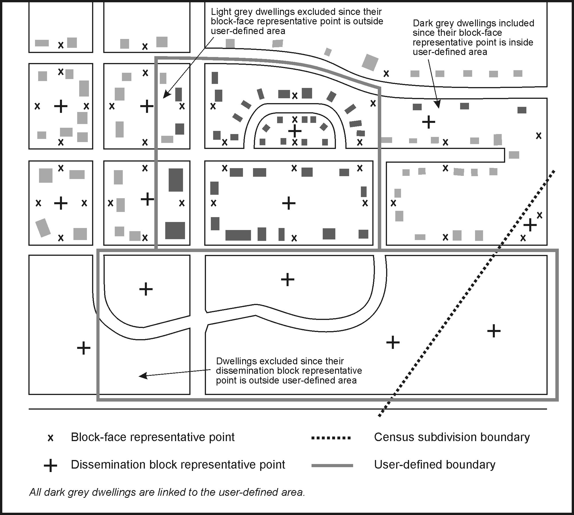
Source: Statistics Canada, 2011 Census of Population.
Refer to related definitions of block-face; census subdivision (CSD); dissemination area (DA); dissemination block (DB); postal code; representative point and Spatial Data Infrastructure (SDI).
Changes prior to the current census
Prior to 2001, households, postal codesOM and place of work data were linked to enumeration area (EA) representative points when they could not be linked to block-face representative points. As well, unrounded block-face population counts were provided for user confirmation before tabulating characteristic data for custom areas.
- Date modified: