
Hierarchy of standard geographic units tutorial, part 2

Archived Content
Information identified as archived is provided for reference, research or recordkeeping purposes. It is not subject to the Government of Canada Web Standards and has not been altered or updated since it was archived. Please "contact us" to request a format other than those available.
The position of each geographic unit in the hierarchy shows how it is related to other units. The highest level of geography used at Statistics Canada is the national level (Canada) and the lowest level is the block-face. Most geographic units can be subdivided or aggregated to form other geographic units.
Using the hierarchy, one can imagine the physical relationship between each geographic area on a map in one of two ways: either moving from largest and very general to smallest and very specific (top-down), or building up from small areas to larger ones (bottom-up).
For example, Canada is divided into provinces and territories, which are further divided into census divisions (regions). These census divisions are then divided into census subdivisions (municipalities), which are eventually divided into dissemination areas, then dissemination blocks. The reverse is also true. One can start with a single dissemination block and continue to build up to most of the higher units of geography until the national level is reached.
In general, there is a 'one-to-many' relationship of geographic areas as you move from the top to the bottom of the chart, and a 'many-to-one' relationship as you move from the bottom to the top.
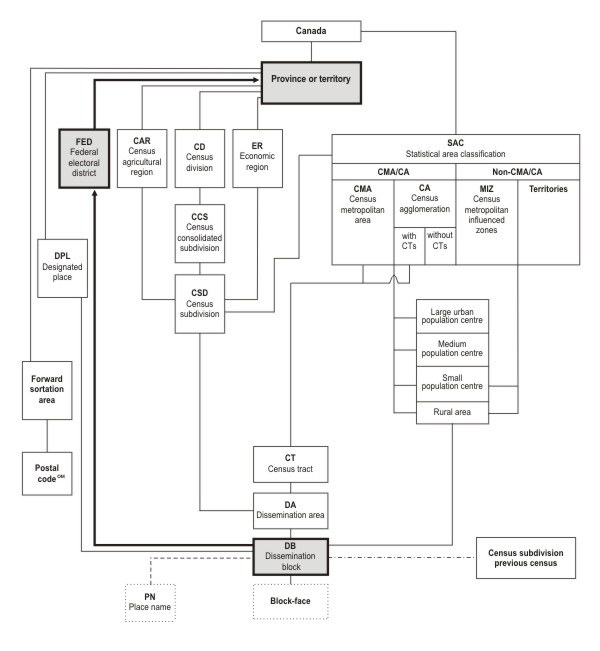
Source: Statistics Canada, 2011 Census of Population.
- Date modified: