
Hierarchy of standard geographic units tutorial, part 3

Archived Content
Information identified as archived is provided for reference, research or recordkeeping purposes. It is not subject to the Government of Canada Web Standards and has not been altered or updated since it was archived. Please "contact us" to request a format other than those available.
Previous | Part 3 of 3
The lines joining the boxes in the hierarchy show that there are relationships between the geographic units. When two boxes are not joined together by a line, then no relationship exists between those geographic units.
For example, dissemination blocks can be aggregated to form both population centres (POPCTRs) and federal electoral districts (FEDs). However, there is no relationship between POPCTR boundaries and FED boundaries. POPCTR and FED boundaries may overlap on a map, but one cannot be aggregated to form the other.
It is important to note that not all geographic areas cover all of the territory of Canada, specifically designated places, population centres, census tracts, and census metropolitan areas and census agglomerations. These areas are built upon groupings of smaller units of geography, based on an established set of rules and population characteristics, to identify areas that represent selected groupings of population.
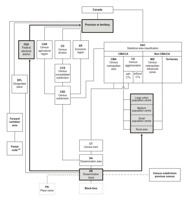
Description for Figure - Hierarchy of standard geographic units
Source: Statistics Canada, 2011 Census of Population.
- Date modified: