
Illustrated Glossary
Map projection
Release date: November 15, 2017
Definition
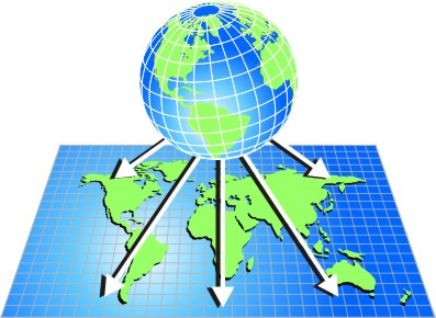
A map projection is the mathematical formula used in the process of transforming positions from the earth's three-dimensional curved surface to a two-dimensional flat surface. The positions on the earth are defined using spherical coordinates of latitude and longitude, usually given in degrees. On a map, the positions may still be defined by spherical coordinates, or by linear coordinates, usually given in metres.
For more information on map projection, consult the Dictionary, Census of Population, 2016.
- Date modified: