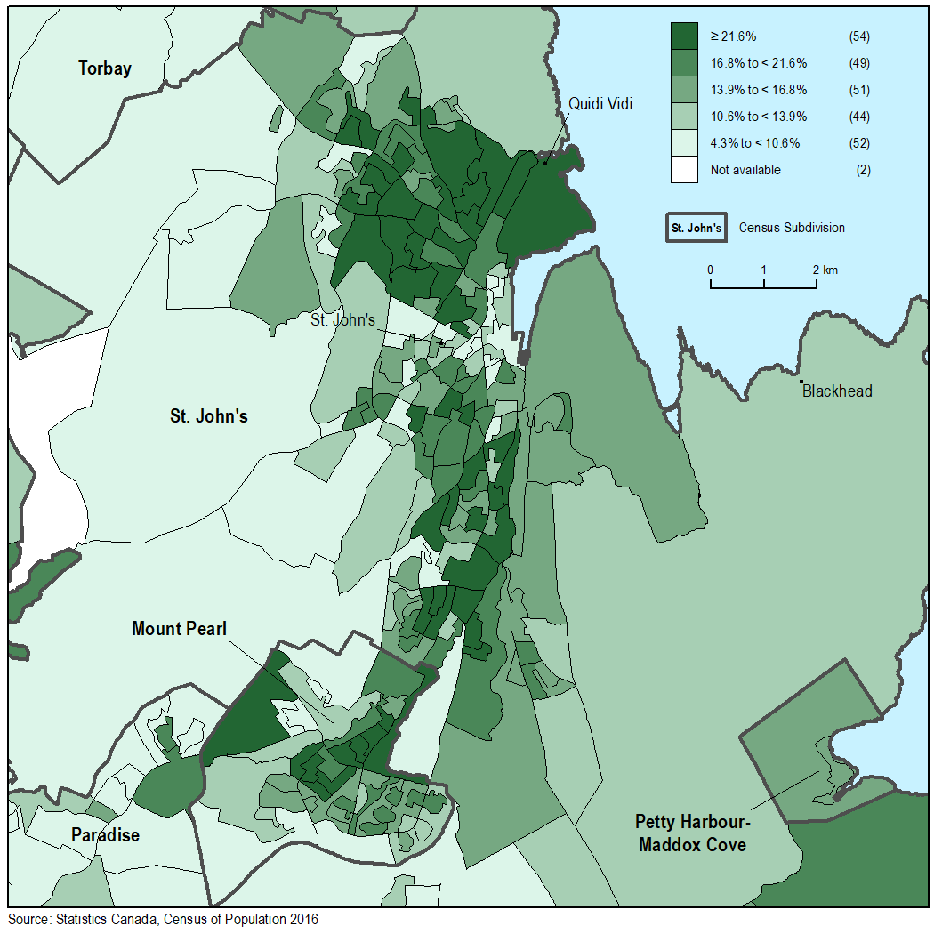
Map 2
Percentage of the population aged 65 and older in St. John's, by dissemination area

Map description
The title of the map is "Percentage of the population aged 65 and older in St. John's, by dissemination area"
This is a map showing the population aged 65 and older in 2016, in percent, by dissemination area for the area of St. John's.
Dissemination areas are outlined with a thin black line while census subdivisions are outlined with a thick dark grey line and labelled in bold black text. A selection of place names are shown by black points and labelled in regular black text.
The legend shows a range of colours for dissemination areas:
Not available in white
4.3% to less than 10.6% in light green
10.6% to less than 13.9% in medium light green
13.9% to less than 16.8% in medium green
16.8% to less than 21.6% in medium dark green
Greater than or equal to 21.6% in dark green
Source: Statistics Canada, Census of Population, 2016.
- Date modified: