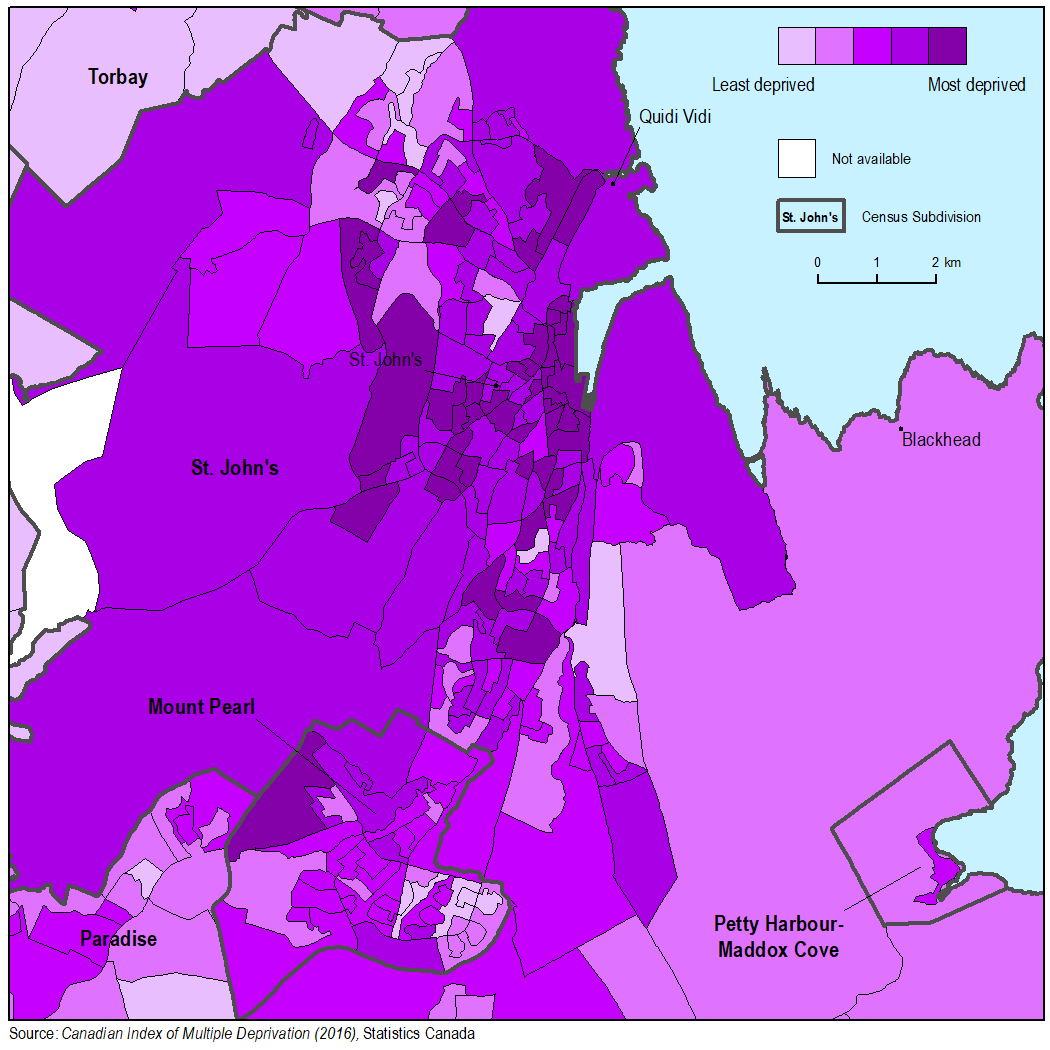
Map 8
Residential instability in St. John's, by dissemination area

Map description
The title of the map is "Residential instability in St. John's, by dissemination area"
This is a map showing residential instability, by dissemination area for the area of St. John's.
Dissemination areas are outlined with a thin black line while census subdivisions are outlined with a thick dark grey line and labelled in bold black text. A selection of place names are shown by black points and labelled in regular black text.
The legend shows a scale of deprivation for dissemination areas, shaded light purple (least deprived) to dark purple (most deprived).
Source:
- Date modified: