|
|
| |
Information identified as archived is provided for reference, research or recordkeeping purposes. It is not subject to the Government of Canada Web Standards and has not been altered or updated since it was archived. Please "contact us" to request a format other than those available.
| Human Activity and the Environment: Annual Statistics
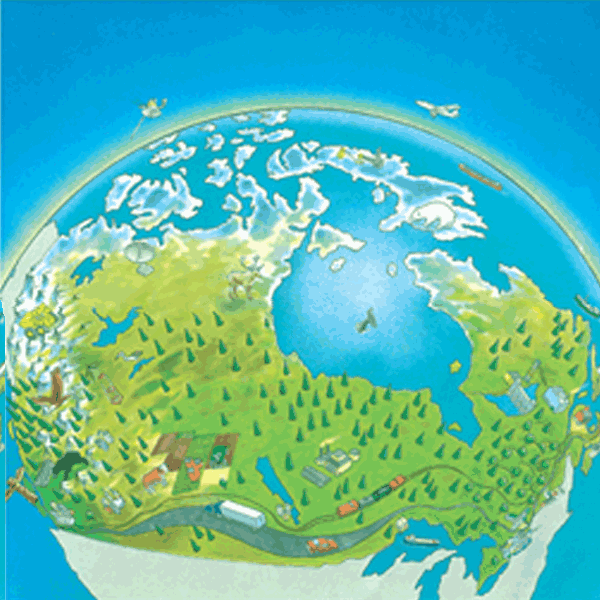
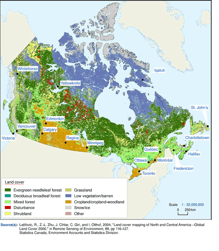
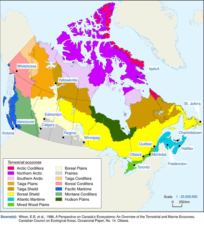
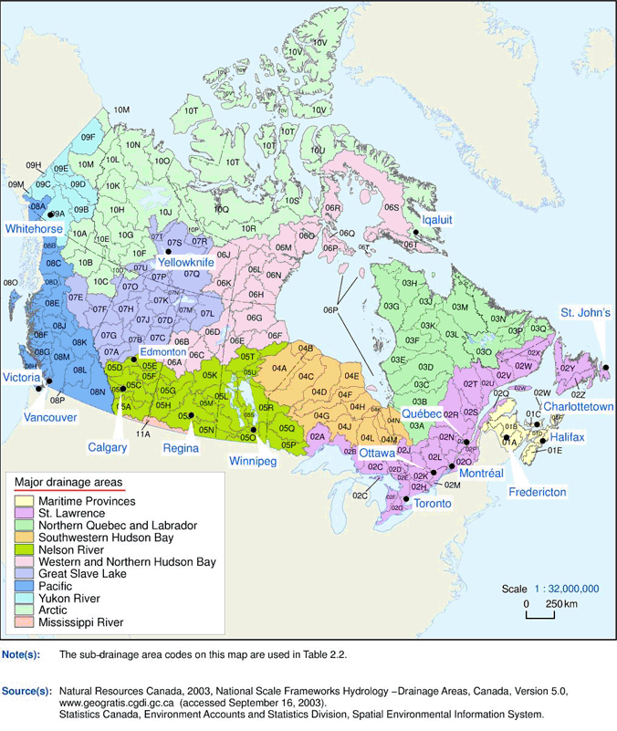
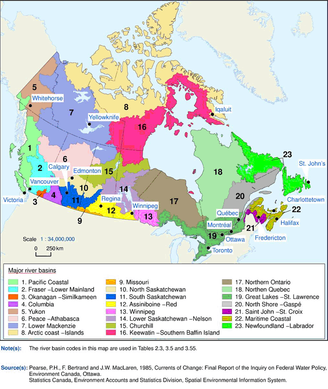
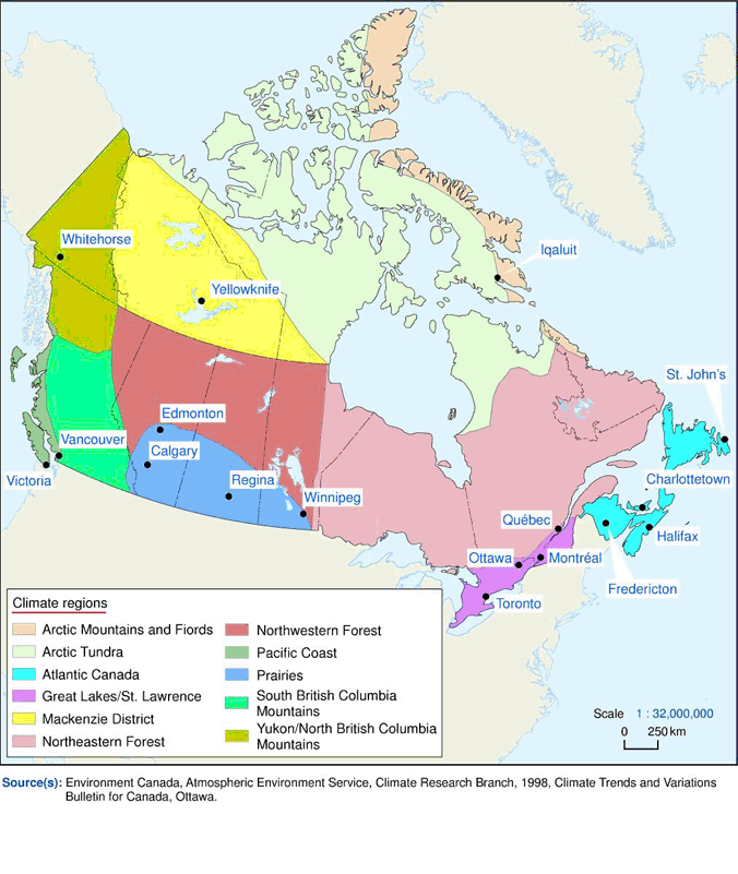
2006 Section II : Annual statistics: Canada's physical environment Physiography, or physical geography, is the study of the physical features of the earth’s surface. This section covers two of the key elements that make up Canada’s physiography: land cover and hydrology. Land cover Land cover represents the surface properties of the land. Land cover information is a basic requirement for the determination of land use and, ultimately, of land value. Canada’s land area totals nearly 10 million km2. The two most extensive land cover types in Canada are evergreen needleleaf forest (26%) and low vegetation/barren (25%), representing just over half of Canada’s land cover. Map 2.1 shows the distribution of 10 different land cover types across Canada. Land cover types and areas are presented by ecozone in table 2.1 . Ecozones The desire for a national approach to ecosystem classification and mapping in Canada led to the development of a hierarchical ecological classification framework. The objective of the approach was to delineate, classify and describe ecologically distinct areas of the earth’s surface at different levels of generalization. The ecological framework was developed by identifying distinct areas of non-living (abiotic) and living (biotic) factors that are ecologically related. From the broadest to the smallest, the hierarchical classification consists of seven levels of generalization: ecozones, ecoprovinces, ecoregions, ecodistricts, ecosections, ecosites and ecoelements. Map 2.2 illustrates the boundary delineations of the country’s 15 terrestrial ecozones. Hydrology Hydrologists identify eleven major drainage areas and 164 sub-drainage areas in Canada. A sub-drainage area is composed of one or more river basins, also called watersheds. A watershed is an area where all surface waters, i.e. runoff from precipitation and snowmelt and streamflow, share the same outlet. Map 2.3 and table 2.2 outline Canada’s major drainage areas and sub-drainage areas. An estimated 12% of Canada, or 1.2 million km2, is covered by lakes and rivers (Table 2.3 ). While many provinces have a substantial amount of water in comparison with their population, only 3% of the area covered by water in Canada is located in inhabited regions. 1 Canada's major river basins and their water resource characteristics are outlined in map 2.4 and table 2.3 respectively. Table 2.4 shows the distribution of streamflow, water area and population for each province and territory. Climate can be defined as the average weather that occurs in a specific area over a period of time. Humans rely heavily on the regularity of climate patterns for almost all of their activities. Climate is measured using various weather elements as indicators. The two essential indicators, temperature and precipitation, are measured systematically at a site over time, accumulating an archive of observations from which climatic summaries can be derived for that location. Daily stations provide readings once or twice daily for temperature and precipitation while principal stations provide hourly readings of more detailed weather information for forecasting purposes. Table 2.5 lists some of the more extreme weather events that affected areas of Canada in 2005. Temperature Drastic changes in temperature signal the change from one season to the next in Canada. Although winters can be bitterly cold, summers can be hot and dry, or hot and humid, depending on the region. Table 2.6 summarizes the mean daily temperatures by month as recorded at selected weather stations across Canada and averaged over the period 1971 to 2000. Chart 2.1 shows the trend in average air temperature in Canada over the last half-century. In recent years, Canada appears to be experiencing warmer average temperatures. Table 2.7 presents temperature trends and departures for the climate regions shown in map 2.5 . 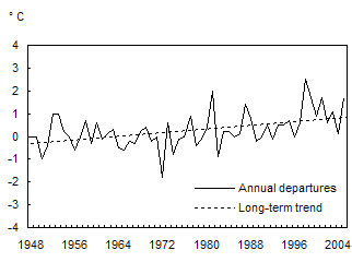
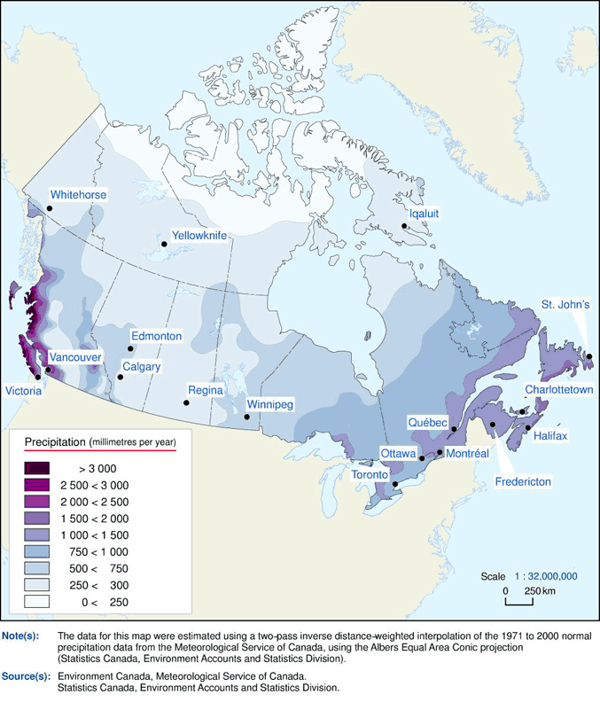
Precipitation Some 5,500 km3 of precipitation falls on Canada every year, mainly in the form of rain and snow. 2 Air masses that carry this precipitation generally circulate from west to east (Map 2.6 ). Chart 2.2 shows the average annual precipitation as recorded at selected weather stations. 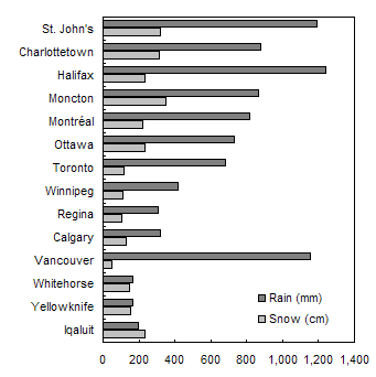
      |
|||||||||||||
|
|
|