Map 12
Crime rate (per 1,000 residents and workers), City of Saskatoon neighbourhoods, 2007

Archived Content
Information identified as archived is provided for reference, research or recordkeeping purposes. It is not subject to the Government of Canada Web Standards and has not been altered or updated since it was archived. Please "contact us" to request a format other than those available.
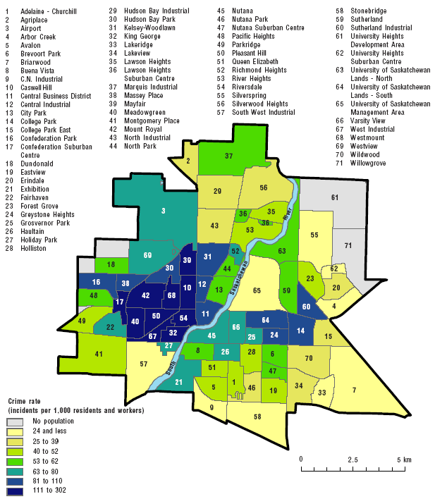
Note: The neighbourhoods were recreated by aggregation of census blocks. In a few exceptional locations, the neighbourhood boundaries as defined by the blocklevel aggregation do not exactly correspond to the official boundaries.
Sources: Statistics Canada, Canadian Centre for Justice Statistics, Incident-based Uniform Crime Reporting Survey, geocoded database, 2001 and City of Saskatoon, Community Services Department, City Planning Branch, 2007.
Map source: Statistics Canada, 2008, "Neighbourhood characteristics and the distribution of crime in Saskatoon", Crime and Justice Research Paper Series, Catalogue number 85-561-X.
- Date modified: