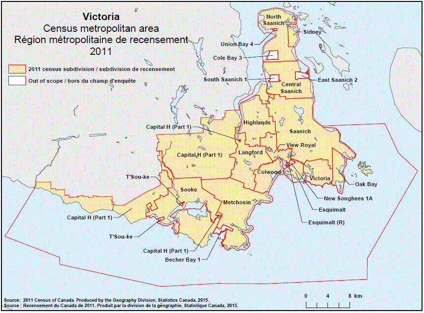
Geographical map of the 2011 Census metropolitan area of Victoria, British Columbia

Geographical map of the 2011 Census metropolitan area of Victoria, British Columbia.

Geographical map of the 2011 Census metropolitan area of Victoria, British Columbia. The following Census subdivisions and Out of scope areas are listed within this region:

Census subdivisions: Capital H (Part 1), Central Saanich, Colwood, Esquimalt, Highlands, Langford, Metchosin, North Saanich, Oak Bay, Saanich, Sidney, Sooke, Victoria, View Royal.

Out of scope areas: Becher Bay 1, Cole Bay 3, East Saanich 2, Esquimalt (R), New Songhees 1A, South Saanich 1, T’Sou-ke, Union Bay 4.

Source:2011 Census of Canada. Produced by the Geography Division, Statistics Canada, 2015.
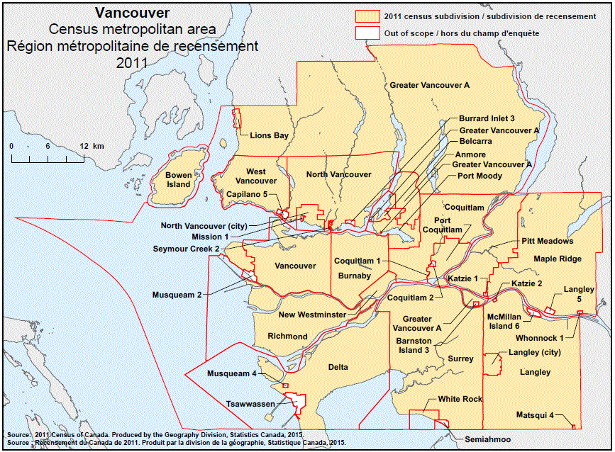
Geographical map of the 2011 Census metropolitan area of Vancouver, British Columbia

Geographical map of the 2011 Census metropolitan area of Vancouver, British Columbia.

Geographical map of the 2011 Census metropolitan area of Vancouver, British Columbia. The following Census subdivisions and Out of scope areas are listed within this region:

Census subdivisions: Anmore, Belcarra, Bowen Island, Burnaby, Coquitlam, Delta, Greater Vancouver A, Langley (city), Langley (district municipality), Lions Bay, Maple Ridge, New Westminster, North Vancouver (city), North Vancouver (district municipality), Pitt Meadows, Port Coquitlam, Port Moody, Richmond, Surrey, Vancouver, West Vancouver, White Rock.

Out of scope areas: Barnston Island 3, Burrard Inlet 3, Capilano 5, Coquitlam 1, Coquitlam 2, Katzie 1, Katzie 2, Langley 5, Matsqui 4, McMillan Island 6, Mission 1, Musqueam 2, Musqueam 4, Semiahmoo, Seymour Creek 2, Tsawwassen, Whonnock 1.

Source:2011 Census of Canada. Produced by the Geography Division, Statistics Canada, 2015.
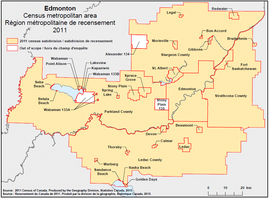
Geographical map of the 2011 Census metropolitan area of Edmonton, Alberta

Geographical map of the 2011 Census metropolitan area of Edmonton, Alberta.

Geographical map of the 2011 Census metropolitan area of Edmonton, Alberta. The following Census subdivisions and Out of scope areas are listed within this region:

Census subdivisions: Beaumont, Betula Beach, Bon Accord, Bruderheim, Calmar, Devon, Edmonton, Fort Saskatchewan, Gibbons, Golden Days, Itaska Beach, Kapasiwin, Lakeview, Leduc, Leduc County, Legal, Morinville, Parkland County, Point Alison, Redwater, Seba Beach, Spring Lake, Spruce Grove, St. Albert, Stony Plain, Strathcona County, Sturgeon County, Sundance Beach, Thorsby, Wabamun, Warburg.

Out of scope areas: Alexander 134, Stony Plain 135, Wabamun 133A, Wabamun 133B.

Source:2011 Census of Canada. Produced by the Geography Division, Statistics Canada, 2015.
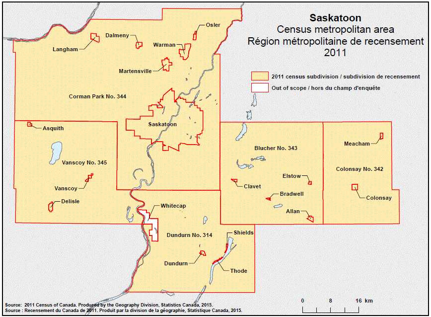
Geographical map of the 2011 Census metropolitan area of Saskatoon, Saskatchewan

Geographical map of the 2011 Census metropolitan area of Saskatoon, Saskatchewan.

Geographical map of the 2011 Census metropolitan area of Saskatoon, Saskatchewan. The following Census subdivisions and Out of scope area are listed within this region:

Census subdivisions: Allan, Asquith, Blucher No. 343, Bradwell, Clavet, Colonsay, Colonsay No. 342, Corman Park No. 344, Dalmeny, Delisle, Dundurn, Dundurn No. 314, Elstow, Langham, Martensville, Meacham, Osler, Saskatoon, Shields, Thode, Vanscoy, Vanscoy No. 345, Warman.

Out of scope area: Whitecap.

Source:2011 Census of Canada. Produced by the Geography Division, Statistics Canada, 2015.
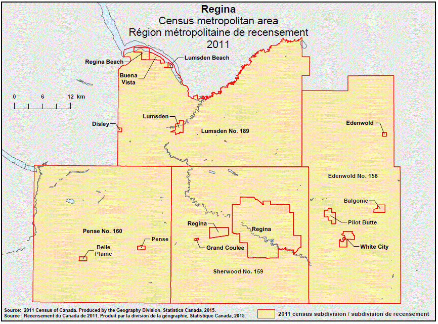
Geographical map of the 2011 Census metropolitan area of Regina, Saskatchewan

Geographical map of the 2011 Census metropolitan area of Regina, Saskatchewan.

Geographical map of the 2011 Census metropolitan area of Regina, Saskatchewan. The following Census subdivisions are listed within this region: Balgonie, Belle Plaine, Buena Vista, Disley, Edenwold, Edenwold No. 158, Grand Coulee, Lumsden, Lumsden Beach, Lumsden No. 189, Pense, Pense No. 160, Pilot Butte, Regina, Regina Beach, Sherwood No. 159, White City.

Source:2011 Census of Canada. Produced by the Geography Division, Statistics Canada, 2015.
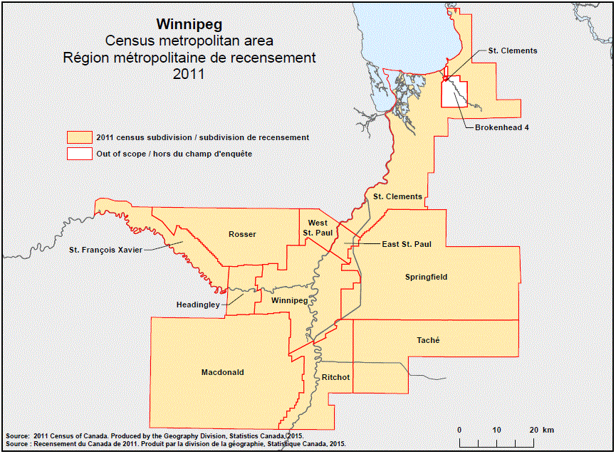
Geographical map of the 2011 Census metropolitan area of Winnipeg, Manitoba

Geographical map of the 2011 Census metropolitan area of Winnipeg, Manitoba.

Geographical map of the 2011 Census metropolitan area of Winnipeg, Manitoba. The following Census subdivisions and Out of scope area are listed within this region:

Census subdivisions: East St. Paul, Headingley, Macdonald, Ritchot, Rosser, Springfield, St. Clements, St. François Xavier, Taché, West St. Paul, Winnipeg.

Out of scope area: Brokenhead 4.

Source:2011 Census of Canada. Produced by the Geography Division, Statistics Canada, 2015.
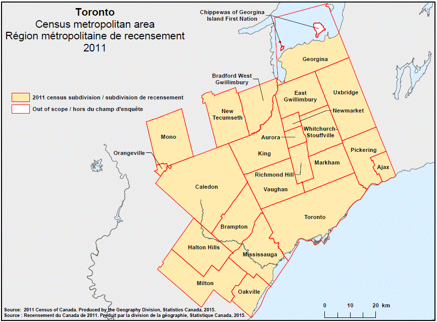
Geographical map of the 2011 Census metropolitan area of Toronto, Ontario

Geographical map of the 2011 Census metropolitan area of Toronto, Ontario.

Geographical map of the 2011 Census metropolitan area of Toronto, Ontario. The following Census subdivisions and Out of scope area are listed within this region:

Census subdivisions: Ajax, Aurora, Bradford West Gwillimbury, Brampton, Caledon, East Gwillimbury, Georgina, Halton Hills, King, Markham, Milton, Mississauga, Mono, New Tecumseth, Newmarket, Oakville, Orangeville, Pickering, Richmond Hill, Toronto, Uxbridge, Vaughan, Whitchurch-Stouffville.

Out of scope area: Chippewas of Georgina Island First Nation.

Source:2011 Census of Canada. Produced by the Geography Division, Statistics Canada, 2015.
Geographical map of the 2011 Census metropolitan area of Thunder Bay, Ontario

Geographical map of the 2011 Census metropolitan area of Thunder Bay, Ontario.

Geographical map of the 2011 Census metropolitan area of Thunder Bay, Ontario. The following Census subdivisions and Out of scope area are listed within this region:

Census subdivisions: Conmee, Gillies, Neebing, O’Connor, Oliver Paipoonge, Shuniah, Thunder Bay.

Out of scope area: Fort William 52.

Source:2011 Census of Canada. Produced by the Geography Division, Statistics Canada, 2015.