A Data Story: Data-driven Insights on the Black Communities in Canada - Transcript
(The Statistics Canada symbol and Canada wordmark appear on screen with the title: "A Data Story: Data-driven Insights on the Black Communities in Canada")
>> Peter Flegel: Afternoon all, thank you for joining statistics Canada event. Cart services are available should you require closed captioning. This virtual event is also being streamed on StatCans Facebook Live and will be recorded and shared on StatCans website Todays event will be in both official languages.
Interpretation services are available by clicking the Globe icon at the bottom right. To hear speakers original audio in both English and French with no interpretation, do not select any channel. It is important that you do not mute the original Cart services are available should you require closed captioning.
This virtual event is also being streamed on StatCans Facebook Live and will be recorded and shared on StatCans website. The Q&A session will follow the panel discussion, and we encourage you to post questions and comments in the chat box and we will do our best to answer them at the end.
The discussion today is intended to highlight StatCan's existing data on Canadas Black community and openly discuss opportunities to strengthen disaggregated data collection. Todays event will be in both official languages. Interpretation services are available by clicking the Globe icon at the bottom right. To hear speakers original audio in both English and French with no interpretation, do not select any channel. It is important that you do not mute the original audio.
That figure is up to one third of businesses in British businesses in British Columbia and Ontario driving both economic growth and employment across the country. In addition, one in four Canadians in the labour market are visible With that said, the pandemic has also highlighted that visible It is imperative that we understand these challenges, particularly how they have impacted specific minority groups to ensure we develop policies and programs being Unfortunately, disaggregated data on businesses owned by visible minorities, including Black-owned businesses, has historically been an area where significant data gaps have existed and the current pandemic has further illuminated these gaps, particularly from a business lens.
>> Peter Flegel: Good day all. thank you for joining Statistics Canada's event: Data-Driven Insights on Black Communities in Canada. I'm Peter Flegel, the Executive Director of the Federal Anti-Racism Secretariat at the Department of Canadian Heritage, and I will be moderating today's event. thank you for joining Statistics Canada's event: Data-Driven Insights on Black Communities in Canada. I'm Peter Flegel, the Executive Director of the Federal Anti-Racism Secretariat at the Department of Canadian Heritage, and I will be moderating today's event. I would like to begin by acknowledging that we are all located on Indigenous land and it is our duty to consistently acknowledge this.
I would like to begin by acknowledging that we are all located on Indigenous land and it is our duty to consistently acknowledge this. Before we begin, I would like to make a few housekeeping announcements: Todays event will be in both official languages. Interpretation services are available by clicking the Globe icon at the bottom right. To hear speakers original audio in both English and French with no interpretation, do not select any channel. It is important that you do not mute the original audio. Cart services are available should you require closed captioning. This virtual event is also being streamed on StatCan's Facebook Live and will be recorded and shared on StatCan's website.
The Q&A session will follow the panel discussion, and we encourage you to post questions and comments in the chat box and we will do our best to answer them at the end.
A couple of people, Alicia and Rola the monitoring that event should any participants have any technical or general questions.
These use the Q&A box exclusively for questions to the panel. The discussion today is intended to highlight stats can data on Canada's Black communities and openly discuss opportunities to strengthen the segregated data collection.
The honourable Augustine Akuoko-Asibey presented the subjective. Black history month 2021 is true is now. This theme was adopted to recognize and highlight that: Now is the time to build on the enormous contributions to all sectors of society that Black communities in Canada have made, and continue to make, to the growth, well-being and prosperity of our country. Now is the time to celebrate and acknowledge the long and rich history of Black communities in our nation. Now is the time to heal the wounds of the past and present, and work towards a better and consciously more inclusive society.
Black history month happens over because it is about the 27th anniversary of the coming into becoming the first Nation's declaration of Canada into January, 2018, the first Minister also announced the government of the 10 year of people of African origin. Dissent.
This year, Black history month will celebrated six-year dissent. The Federal Anti-Racism Secretariat is committed to working with diverse Black communities to ensure recovery measures from the federal family are more equitable, and address the specific challenges faced by people of African descent in Canada.
We believe that it is through continued dialogue that we can foster a stronger relationship with communities and thus, continue to build trust and collaboration between the Government of Canada and communities. I am excited to introduce the fantastic group of panelists who will share their expertise on the matter. Before I do so, I welcome the Chief Statistician, Mr.
Anil Arora, with some opening remarks, followed by a keynote address by Directors, Ms. Tina Chui and Mr. Augustine Akuoko-Asibey. Over to you.
>> Anil Arora: Thank you very much Peter for that very kind introduction and for those opening remarks. I would like to acknowledge that I am speaking to you from the traditional unceded territory of the Algonquin people.
I want to thank todays participants and everyone watching, for joining us in this timely and important discussion during Black History Month.
As you all know, we take our work at statistics Canada very seriously and we know what is your and share shapes this course and allows us as a society to know our strengths and weaknesses and shapes priorities and policies direction.
Equally, what we cannot measure or do not shed light on has consequences. We not only passively put out data but facilitate dialogue and thus helps the 8 policy options and ability to ask better questions.
We beyond simply providing objective facts but we portray the dreams, aspirations, of our society. For example, cap the population of Canada thinks flaming opportunities are better than their parents. For black Canadians, a full three quarters think the same.
We are always striving to provide a complete story with facts to robust evidence and experience and we have many chapters to instill rights in the story when it comes to black Canadians and that is of a fully inclusive society and economy.
We are truly fortunate to have a census of the population conducted every 5 years in this country and serves as an extremely important baseline kept up-to-date can base our surveys in our programs upon. As you know, we are in the process of finalizing the 2021 Census to be conducted in May of this very year. Our agency is well on its way to modernizing and keeping up with the demands for data and analysis. We now use innovative collection methods and integrated data and new sources.
That I can say unequivocally that the pandemic has made the work of this aggravating data based on ethnicity, gender and other key social lenses and emerging priorities and delivering on this necessity and this data can help measure our nations progress towards a fairer and more open society especially as we move from pandemic response to recovery.
My colleagues Augustine Akuoko-Asibey and Tina Chui are ready to tell you more about what we have done and what we are doing and what we must do and it is my pleasure to ask them to take it from here so I thank you, again for joining us, today.
Thank you, two our distinguished panelists and I hope you enjoy and take away a few key points from today's session. I will join you at the end of the session for some closing remarks. Thank you, and MERCI!
>> Tina Chui: Thank you, ANIL, it is an honour to be speaking at this data story event and to join this timely and necessary conversation and I would like to begin with the statement that may seem obvious. We all come from different places and I know that I have not experience the discrimination and racism that a black Canadian might face every day.
My experience is of an immigrant woman who identifies and can also be perceived as a visible minority. I am also someone who has dedicated her career to the protection and analysis of social statistics at statistics Canada and I hope I bring to you today some relevant information from our agency to contribute to our discussion and I would also like to hear your data needs so I could bring back to my team for our planning going forward.
The key information on black Canadians have been from the census-- a gold mine of data on the demographic contribution of black Canadians.
From the census, we know that the black population has played a significant role to defy Canada's diversity. In 1871, the black population in Canada was estimated to be just over 20,000 people in this figure did not change through the first half of the 20th century. In 1951, the black population in Canada was estimated to be about 218,000 people or about 1 percent of the population.
After world War, things change rapidly and we saw greater diversity in immigration. Between 1971 and 1981, the black population by 600 percent reaching a quarter million people. From 1976 to 2016, the black population has doubled from nearly 600,000 to just under 1.2 million accounting for 3.5 percent of Canada's total population.
According to our projections, it suggests this could increase to as much as 5.6 percent by 2036. This growth also brought greater diversity. (SPEAKING FRENCH) Almost twice as many black people experience poor housing needs compared to other Canadians. (SPEAKING FRENCH) The Covid 19 hit us, then Covid 19 hit us and its impact has been felt. Left Canadians on the front line in the fight against the virus.
One fifth of employed black Canadians worked in the healthcare industry putting them at greater risk of exposure. We also see the economic impact of Covid 19 falling disproportionately on black Canadians. The labour force survey revealed that unemployment rate for black Canadians were significantly higher than in words, the pressure applied by the pandemic is only aggravating inequalities. Despite these challenges, there are reasons to be optimistic.
(SPEAKING FRENCH) Nearly all black surveyed say they want to achieve a bachelor agree that use are also on unequal footing with White youth in terms of mental health and are less likely to experience suicidal thoughts then white youth.
(SPEAKING FRENCH) Statistics Canada says (SPEAKING FRENCH) The census is the foundation of our knowledge on black Canadians and the only source that can highlight how to row Genuity of the black population. Taking place in May, we will bring this information up-to-date and we are also looking at ways to further disaggregate all the black communities in our dissemination of the census results.
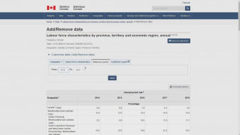
Many surveys have increased their sample sizes in order to present more details segregated data. For example, the survey on social identity and the labours for survey produced up-to-date employment rates for populations including black people but gaps continue to exist and there are still a lot to be done-- in particular, our health and justice and community data are incomplete among many priorities, need mortality rates disaggregated by racialized communities to better understand how Covid 19 and other courses of death disproportionately affect the black population.
We also left data on Canadian businesses operated by black Canadians and to speak more about this gap and the economic size of the issue, our next speaker will be Augustine Auoko-Asibey, Director of agriculture at statistics Canada.
>> Augustine Akuko-Asibey: Thank you very much Tina, I hope you can hear me well. From an economic perspective, it is no question that prosperity and diversity both go hand-in-hand. Simply put-- canada should job innovation and dream. Visible minority abilities including the black community to see how diversity is a driver of the Canadian economy, with businesses across Canada being run by visible minorities (one and 4) Driving both economic growth and employment across the country.
In addition, one in 4 Canadians in the labour market are visible minorities. And immigrants are highly educated in comparison to Canadian and essential to fill the vast number of professional scientific and technical positions we see in Canada.
With that said, the pandemic has also highlighted that visible minorities have faced challenges-- particularly in finance, a revenue losses during the Covid 19 pandemic.
(SPEAKING FRENCH)
The promising source of this information for businesses or statistics Canada is what we just got from the Canadian revenue agency to provide all that he businesses by industry and region. However, as a data collector by the Canada revenue agency, that does not include information of business ownership by minority groups and leaves us with estimates in this piece.
Why do statistics Canada have been tracking social economic populations of some group and particularly woman or visible minorities at large for some time-- we still have ways to go to better understand the impact on visible minorities on the economy at large. Questions we need to be able to answer is the program decisions include: what is the proportion of the economy that includes the black community and other groups.
What proportion of premiers are black Canadians and do they have wall assets to finance their capital to expand and grow their businesses? What proportion of black Canadians are in senior influential positions?
We know that diversity is our strength and we know that investing this diverse city will reap benefits but without understanding the facts and trends in the data to inform decisions and investments, we are missing opportunities to effectively grow our economy by leaving talent behind.
With a greater emphasis on the importance of this data, statistics Canada has taken the following actions to collect this information and better understand the impact on minorities or businesses-- specifically, the survey on business conditions in collaboration with the Canadian finance to measure the impact of the pandemic of business conditions.
Statistics Canada added a self identification question on the Canadian survey to collect data civic to minority groups including black owned businesses. There is also a survey on financing and growth of small to medium enterprises and statistics Canada has agreed to collect more detailed information on specific minority groups in the survey to be conducted in 2021 which is new and to the survey and will allow us to access more data for specific minority groups and small to medium enterprises.
There is also knowledge following the prime ministers announcement to support black owned businesses in 2020, statistics Canada continues to watch closely with partners to support this initiative especially in our interest on this new program and the support it to success in any way they can.
Addressing the data and better understanding the economic conditions for black-owned businesses and we acknowledge our position in the space. To conclude, the data we get from businesses owned by specific groups, indigenous and specifically visible minority groups is essential to ensure inform policies and programs are put in place to support a truly inclusive economic recovery. Collusive growth is the hat of Canada's prosperity and want to make sure we can adapt better in this space and opportunities to invest in assets and take on partnerships and business communities and with that, our transition to Peter...
>> Peter Flegel: Thank you very much. Thank you, Anil, Tina, Augustine and Statistics Canada, for hosting this event. For those really good words of introduction. Now, over to the panel discussion. Like I mentioned earlier, I would like to introduce the well-versed group of panelists here with us today. We are very fortunate to have Dr. Malinda Smith, Dr. Malinda S. Smith inaugural vice Provost and a professor of political science professor at the University of Calgary. She serves on the Statistics Canada Working Group on Black communities in Canada, the Canada Research Chairs Advisory Committee on Equity, Diversity, and Inclusion Policy, and the Inter-Institutional Advisory Committee for National Dialogues and Action for Inclusive Higher Education and Communities. She is a former Vice President Equity Issues for the Federation for the Humanities and Social Sciences, and currently serves as Chair of its Advisory Committee on Equity, Diversity, Inclusion and Decolonization.
Next, we have Richard Sharpe has worked within the Federal Public Service for over 24 years. He has recently been appointed as the Director of the Racial Equality, Anti-racism, Diversity and Inclusion Initiative at the Department of Justice Canada. Richard is currently winding up an Interchange Canada assignment with the Dream Legacy Foundation. His work involved leading initiatives in support of the Government of Canada commitments to the United Nations International Decade for People of African Descent. Richard is one of the founders of the Federal Black Employee Caucus that has been working with federal public service and union leadership to address anti-black racism in the federal public service. Over the last few years, Richard has been a speaker on addressing systemic racism, anti-black racism and providing insight on how to be an ally within the Black Lives Matter movement.
And from the BlackNorth Initiative, we have Dahabo Ahmed-Omer: Dahabo has accumulated a wealth of experience and accomplishments in the performance measurement, policy development, HR planning analysis and employment equity and diversity sectors. Ms. Ahmed has been the recipient of notable awards over the years including the exceptional service within the Federal Public Service, the Canada150 Community Builder Award, The Hope Academy community contribution award, the Ottawa Black History Community Leadership Award and most recently the top 100 under 40 Most Influential Person of African descent in support of United Nations decade.
(SPEAKING FRENCH) Madame Myrlande Pierre... is responsible for the mandate of that mission by the charter of human freedom and rights and the surveillance on the equality and equal access to work in public services, racist files fluting profile racial profiling are under her responsibility, she is an expert and a nationally recognized in social economic integration and particularly on socioeconomic integration, cases of discrimination and the importance are the cornerstones of her work.
>> Peter Flegel: Finally, we have Dr. Lance McCready from the University of Toronto. Dr. McCready's research program is concerned with the education, health and well-being of urban youth. His most recent research focuses on the educational trajectories of young black men in Canadian urban centres, and programs and services for ethnic and racial minority males who are underrepresented in North American colleges and Universities. Conceptually, he is interested in the way intersectionality, social determinants of health, and gender relations frameworks can be mobilized to develop more effective programs that promote academic achievement, well-being, school engagement, and access to higher education.
So thank you all for joining us, today, so let's start the panel discussion.
You will each have 9 minutes to answer and also leave time for questions.
Perhaps, start off with Dahabo. According to the most recent Census, 3.5% of Canada’s population is Black. The Black North Initiative based their corporate pledge on this data to set the goal of corporations having a minimum of 3.5% of executive and board roles based in Canada being held by Black leaders by 2025. Many have said that the reason this is not already a reality is because anti-Black racism is pervasive in sectors across Canada, including data gathering and analysis. What's your take on the relationship between data and representation in the business world?
>> Dahabo Ahmed Omer: Thank you, Peter. And thank you, ANIL, it's nice to see you again and so many familiar faces, Tina of course Peter yourself. I am really glad to be part of this conversation and I know that generally across all of our sectors have been talking about data and the importance of statistical data and the impact it has on the way better and an equitable society for black Canadians.
You know, the reality Peter is that the context in which Black communities live in today is quite stark and quite a horrendous reality and I just was reading today snapshot that statistics Canada put out and realizing that the idea of what we thought was happening by communities in Covid 19 and having numbers tell us sort of that reality and experiences, it's scary you know.
I was reading the numbers and as I kept going through, it's just one page and it's just a snapshot and I can't wait to see sort of the details. But for now, the reality for black Canadians is worse then what we ever thought. Covid 19 is obviously nothing about Covid 19 as racist.
I think the challenge faced by black communities is there an highlighted and heightened by Covid 19. Say to ourselves that we will be able to build a society that is going to be more inclusive-- will have to look at the reality of black Canadians.
I will tell you right now, free percent of black Canadians said they're being treated unfairly while 52 percent of the community thinks discrimination is no longer a problem.
Those things, power we as a society going to combat an issue in terms of acknowledge meant. I know there is in a debate on antiblack racism but the statistics tell us otherwise.
They tell us there is visuals and institutions and sectors that don't believe this is an issue so if we go further into that and asking about the relation between the issue and the data-- you know, when we look at the reality of black Canadians, I want us to think about entire facets of who a black Canadian is.
I could tell you today that the black people face to reduce likelihood of ceding a job hiring process, having an impaired career progression, access to healthcare and mental mental healthcare generally. They have lower educational achievement and over policed.
So, in every single sector, black Canadians are impacted in a negative way. There was an report done by stats Canada in July of last year that said black Canadians are nearly two times more likely to be unemployed than nonminority Canadians, and it 70 percent or than non-visible minority Canadians-- a snapshot that shows today. So you can imagine, we are dealing with the collide of two pandemics, the racial pandemic and Covid 19 pandemic coming together and killing black Canadians every single day.
So the relationship for me is one that is actually costing lives. So we have Black communities that are unable to take care of their families and getting proper healthcare. University educated black Canadians on average, sense to every dollar when compared to their white peers. That is 20 cents.
I give you these numbers because I think it's important for you to understand the gaps are real and represent people. Every number I give you I want you to close your eyes and think about human being, think of a person, your neighbour, your colleague, your friends, people into our communities that are being impacted in such a way that it does not allow them to survive or thrive in this world.
The earning gap shows that black Canadians do not have the same return on educational investments as white Canadians. On average, a black Canadian worker earns about $12,004 less impaired to other Canadians. The wage discrimination in itself is costing right now...is occupational segregation, let's call it for what it is, is costing the black community $1.5 billion annually. $1.5 billion is being taken away from Black communities every single year.
So the relationship between data and the way that we create an inclusive society great. I think there was a time where we were screaming on top of our lungs and using anecdotal evidence to push the conversation forward, but now there is overwhelming data and numbers, overwhelming amount of evidence that is showing us that the reality is not what we hoped it to be.
So it starts everywhere, is happening across the board and if we just look at the opportunities to grow within-- economically grow, so there was a... University of Toronto did sort of a white tint resume project in the study and it was part of the race and safe preservation.
It began in 2016 or 2017, GG or everyone correct me on that if I'm wrong. Studies show that relation in resume screening-- just for having a black name is getting up to 12 times of the work callbacks for black Canadians.
Just by having something that sounds like a black name. I don't even know what a black sounding name is and I think my name sounds fantastic!
My name means gold. It's a cultural name and I don't think there such thing as a black name or white name, but it's these unconscious biases. Answer to racism and its reason why white resumes with no criminal record gets three times more call back and if you look at white resumes with criminal records-- they get 12 times more call back similar black resumes.
I mean, these are the things that we are dealing with, and so, it saddens me and it's disheartening to know that your name-- something that is given to you for the moment coming to this earth literally starts at that very moment, the first identity you're given us something that will hold you back surviving and thriving in prospering society.
Imagine that-- just your name, hadn't had an opportunity to do anything in society yet but just your name. You know when the corporate world, it's the same everywhere and black Canadians, they make up less than 1 percent of senior executives.
Senior leadership sort of roles-- I think they represent .0.8 percent, representing 3.5 percent of our population in Canada.
So I asked why 7 of the largest Black communities don't have any black executives, how come the 5 largest banks don't have any black executives, how come the largest telecom companies do not have a single black executive? These are in enormous gap so if we are truly to use that data to create that sense of belonging and inclusivity and equity and these are fantastic words we use, cannot just say will now get rid of those numbers and just put black bodies in those roles.
That is not equity either and that is not inclusion either and I will tell you what-- I want everyone who is here to listen to me and I know there's a couple hundred of people here so this is a great opportunity to talk to its many of you as possible.
If you look at representation, it's not about putting a black body into a leadership role, it's far from it, in fact it's about creating an environment around them that allows, and for them to feel like they belong, as though they understand why they are there.
They are not there because of the colour of their skin but really there because of their skill sets, of their experiences, of their educational background and professional background, but also to understand the fact that they are from an minority community that is now an asset-- is not an impediment or detriment anymore.
It adds to the value. There was work done for McKenzie which is a company that works in BlackNorth, and they realize that it actually makes, a company makes more money when their workforce is diverse because of the skill sets that are at the table.
You are literally leaving money at the table by not insuring your company is diverse and as wide and great and grand as nature. It saddens me when I think about these things because, again, the reality in every sector. I want you to ask yourself and I think I will probably get cut off by Peter which he just try to do that to me, Peter I will say one more thing because I think it's important to say, I want to-- for all the leaders on the line here today, I want you to think about something.
Which is when you look at your black staff and representation. Want you to think about the fact that these communities are dealing with challenges and by the time they come into the workforce, they have dealt with an enormous amount of racism and racial discrimination. There is enough facts out there and I want you to say what will you do to support these individuals so that they do not suffer any longer and you will look at, the entire facet of who they are you won't just look at one part of who they are but you will look at everything, the access to healthcare, their growth in your workforce, the fact that 41 percent of black Canadians right now who are impacted by police grounding our black people.
46 percent of people the police uses tasers on his black people in same thing in places, pepper sprayed, 46 percent of them are black people and these are your people in your community so there such a relationship there and I want to start to look at the entire person from birth to this moment: how to make that person included to our workspace and how do we do that?
>> Peter Flegel: Thank you, for that very insightful relationship between all the data at our disposal and discrepancies feeling systemic barriers see in the private sector and written large across Canadian societies.
Which brings us to our next catalyst. Richard Sharpe. Statistics Canada has a lot of data around populations designated as visible minorities which has been used in various ways. In your view, what are gaps that exist in what and how we collect? When you consider how this data is applied (for example in establishing representative leadership goals) what do you think we need to do differently in the short, medium and long term?
>> Richard Sharpe: Thank you, Peter and thank you to Anil, Tina and Augustine, I'm grateful to be on this panel distinguished panelists.
Before I start, sorry lost my posted stuff-- can you guys still see me?
>> Peter Flegel: No we cannot.
>> Sorry were just having connection if so we took you video to be able to hear you better.
>> Dahabo Ahmed Omer:
>> Richard Sharpe: Sorry I thought I went dark before I had a chance to speak about is fine. I just wanted to say right off the top that-- if I'm standing tall it's definitely on the shoulder of my brothers and sisters.
I know from my understanding of this years Black history month, for me it's not only around the recognition of past contributions for people in this country but it is also about justice and development of black people in Canada. After all, Justice and development are themes of the International decade of people with African Descent and we are in the middle of historic times.
Our discussions of how we address the black experience must be focused on what we need to do to address historic injustices and antiblack racism spirits in our society, our previous speaker spoke to this online that our reality is not a rosy one in this country.
We only have three years left of a decade so we are looking for some tangible results to support for that decade. In response to the question that you pose Peter... I think stats Canada has been doing an excellent job of collecting data.
They have demonstrated excellent data collection usage. I think the relation here just to be a bit provocative, has been the profound fear of data in this country and what it tells us about what. I'm also saying that discrepancies will be... in the federal and public services.
Stats Canada has one of the tools with they provided to us and made available to us on demand, and so this allows us as part of our workforce and for recruitment, and retention, and what I think into the future. So, with that and we asked from stats Canada to be able only so much just that.
We are now moving into a space to our central agencies are asking. Data after much requests to look at issues we know that visible minorities, hey visible minority term reflects the reality of the Black communities it not homogenous group, so what we need to do let's look at how to not only disaggregate that data but look to the of our workforce and our future realities of our population and the lack of internal federal government disaggregated workforce has been an issue in terms of being able to plan for the future.
Addressing the challenges in the gaps that we have within 4 black and indigenous people and people. The reports that came out our golden and experience I've had a black people in this country, that is not my issue.
My issue is central around how we something called workforce availability data and the fact that it always seems to underreport the true representation of folks in this country and that is why of the discrimination secretary in the Department of Justice I am working Closely with ANIL'S to get modelling and tools to do some work that I will talk about next to address racism and discrimination in the organization and in terms of the gaps-- I feel that again, stats Canada and support workplace research and data and demographics in order to help place with the changing and growing population.
Need to address our dependency on outdated sources, years to create the creation of data and reports by our central agencies and then used by our departments and sectors, we need to have a better understanding of how this impacts on the policies and programming decisions around employment for black and indigenous racialized. We also need-- I would also ask stats Canada to support us on this, develop a better understanding on what intersection now it is.
It is not very well understood in the antiracism contacts in the public sector and people do not have a good understanding of it so that makes it difficult to translate that into practical terms. Data and research supports misunderstanding. In terms of when considering how data is used, what do we need do differently?
Again, I think stats Canada is rising to the occasion and providing us with more information that we can. And this is a time where our communities and governments have called for some meaningful changes to address systemic racism as we have heard, this is not work for the faint of heart and having good data surrounding our work makes it possible for us to again make decisions, so for me in the short term, stats Canada can help us in establishing fictive modelling or forecasted demographic workforce to help us understand what is happening in Canada now and what our workforce reality is and what it would be in the last 1015 years and where able to do that for the general population but for some reason, we aren't able to do that within the public service.
We are constantly looking back, for so 5 to 8 years for representation numbers to establish baselines that are on ballistic and do not serve us well in terms of making sure that our workforces are represented. If we are truly married to workforces ability, we should make sure the numbers are grounded so like I am saying, I'm repeating myself in current and future realities-- if three-point 5 percent candidates population are determined to be black 2016 and our numbers are growing in this country doubling every 20 years, in 5 years a lot can happen. Is our real representation dates today? What about in 2025, w.
>> How do we translate that in terms of how we plan for workforce so again, in the medium turn our departments need to see how we address this the best way possible. That is again, something stats Canada is available to help us with and I'm not sure where using stats as much as we should.
So doing some of the work has become a challenge in terms of us basing it on reality and I think predictive modelling should be foundational to workforce availability.
That is again, why we are working with stats put something in place that not only might work for Jay but for the rest of public service. Thank you.
>> Peter Flegel: Wonderful, thank you so much Richard for having given us some good ideas for how we can make use of statistics Canada and now we will be to Myrlande Pierre Based on your experiences, what are the challenges pertaining to the collection of diversity and inclusion data at the institutional level â€" e.g., Public service, universities or the education sector, police services, businesses, health, etc.?
>> Myrlande Pierre: Thank you, for the invitation by statistics Canada. And thank you to ANIL, for this invitation. It's an honour to be on this panel and have this conversation together.
It's a conversation that's not only necessary but it's not an easy conversation to speak about racism and discrimination and these are conversations that are challenging, but we are at a turning point in our history.
In our social context, to note the concerns of civil society and how we need to be called exponentially respond.
Before I have a specific answer to your question-- and to get into the heart of this question, I would like to contextualize a little bit, because I believe before speaking about data, need to situate the challenges. This means that we need to look at certain questions that are key in my opinion.
What are the main challenges to fight against systemic and structural in the employment and other sectors? For example, security, public safety, education, employment, it is important to have that integration but as well, for participation so I think these are the issues that need to guide the research methodology and how we can highlight and make this data useful. Another question that seems important to me is-- what are the imperatives that we need to look at so that institutions, all institutions, democratic, as well as administrative, or state run organizations, Crown corporations, can have either membership on the Black communities.
I think this is on the strategy of collective goodwill and data collection, as well as how we can take into account the fact that Black communities and indigenous communities have a systemic discrimination in other sectors that compromise fundamental rights to work, in Quebec as well as in Canada in terms of discrimination in employment, Mike particular area of interest-- because all my academic baggage comes, I have the expertise as well in that area.
It is the charter of rights and liberties in Quebec and also the Canadian charter of rights and freedoms. There are laws to ensure representation of groups that are victims of discrimination, so when the government or minister strategy needs to take all these issues into account so the actions that prioritized, we need to take into account the reality and as it was mentioned before me-- there are realities that called out to all parts of society.
Collectively, need to handle and address these challenges and speak about the reality of the black community of QUEBEC and of Canada and we cannot do that without speaking about stomach discrimination and racism.
So that would be my answer. There's a whole context as well, it invites us to look at the entirety of this issue, we have people of Afghan dissent that need to-- then need the involvement of everyone in order to carry out the promotion of respect and of human rights, and of rights and freedom for those of Afghan dissent, as well as the cultural diversity and patrimony which every day, it is more diverse and another important aspect I would like to talk about is when you talk about lack communities, they are not the monolithic unit, they're not an homogenous group, there's a lot of diversity about linguistic diversity, generational-- for certain communities for example, in Montreal and Quebec, THE HATIAN, speak about second or third generation of immigrants, speak about young active members of the Canadian society were educated here in Canada share all the values that we hold that they are confronted by discrimination and by racism, unfortunately.
Speak about an underrepresentation of Black communities in the public sectors, senior executives, to look at certain particularities for black woman in the public sector, and intersection analogy, helps us takes into account signs of discrimination as well, the relationship between intersection analogy within society that process within our society and this is key to me and before even speaking about the hall importance of data collection which must come from and which much the port the social observation we have, it's always a complementary approach in the analysis of the data collection is complementary to in-depth and quality analysis where we can understand problems that the various communities deal with-in terms of Black communities.
So I will not get into all the statistical data because I think you have already shown disparities that exist whether among the youth, or the wall of the black community, the higher rates of unemployment, policing the racial profiling the young blacks-- 4 or 5 times more likely to be called out by the police. So there is a problem we have is a society to resolve in a lasting way. You have a little just more Peter?
>> Peter Flegel: Two minutes.
>> Myrlande Pierre: So the intersectionality within the context of analysis in order to understand how these various forms of discrimination are showing themselves, I would also like to say-- as regards to data collection, we need to take into account the whole issue of this aggregated data which seem so fundamental to me because this helps drive public policy. Taken into account, complex and multifaceted effects of the black community.
Here I am speaking about disaggregated data rights, YOUTH RIGHTS, we recommend b that they be collected in a national, ethnic but also race and disabilities and other factors that can make the reality even more complex for certain groups of people. In healthcare, the current health crisis, unprecedented health crisis has on exasperated the inequalities and we have a marginalized group who was already victimized, already experiencing various forms of discrimination and the fact that this pandemic shed light on social inequalities and racial inequalities, by collecting the data through the human rights commission, this has been an invitation to collect the data in order to meet the needs of the population and we see how these racial and social inequalities are exasperated by this pandemic and shed light, and differentiation between noxious expert as well as race.
For example, in a black community or woman... there are women who are victims of racism and this is very evidence on the front lines. Populations are affected by the health crisis, so it's in exasperation, of social inequalities and data collections both in healthcare sent public health and safety and in terms of law and must take into account the entire complexity of these realities. So I will and here. I could keep on talking quite well. But thank you.
>> Peter Flegel: Thank you, for having me follow these points and dealing with the complexities and contacts which are faced by. And now we will hear from Dr. Lance T. McCready As we've mentioned one of the goals of data is to help create and reflect a narrative. There is a commonly held belief that Black youth (particularly Black male youth) are less likely to graduate from high school; we often hear about the school to prison pipeline. What data is supporting this narrative and is it accurate? Do we need to be supporting public institutions like schools and provincial health bodies to collect better data that can be used to provide better programming that leads to better outcomes for Black youth?
>> Dr. Lance McCready: Thank you very much and I'm happy to be participating on this panel with such analysts as well.
I actually think that the way this question is phrased is a bit curious [laughing] there's a lot of quotes that call into question whether or not the school to prison pipeline, the disproportionate expulsion in disciplinary actions taken against black students are indeed true. I want to first argue that, yes, it is indeed true.
But before we sort of through all that-- what I want to do is I want to provide a definition of the school-to-prison pipeline.
Do know definitively that black people are overrepresented in candidates prison. At least 8 points 6 percent in federal prisons and 3 percent of the populations. So they are definitely overrepresented in Canada's population.
The term school-to-prison pipeline aims to highlight a complex network of relations that naturalize of youth of colour in our schools and communities into underemployment and permanent detention. This is not a novel phenomenon.
Public education in Canada has historically framed particular populations as more surplus or peripheral to our democracy yet imperative for low-wage work and jobs available for white employment.
With indigenous as eventual schools, segregated schools, chronicle access to resource and public education has final and target non-white and YOUTH, participation in the streets or economy or prison. This is also drawn on the part of Eric miners living in the US Canadian scholar, who is a well-known sort of researcher of prison.
How do we know that a school-to-prison pipeline exists. I think we heard some about that outcome data from stats Canada, 7 out of 10 black adults how to postsecondary diploma, that the higher education attainment of the black population immigration status. Only 60 percent thought that they actually could get that out of 97 percent of the black population who want to get a degree.
I think that there are many authors such as Carl James and others who have provided pretty compelling evidence that perceptions of being able to obtain a postsecondary degree are related to there and interactions with teachers and other people in the school education system.
I actually do not think a lot of the stats Canada can really shed a lot of lights on the particular mechanisms within schools that sort of contributes to a school-to-prison pipeline.
So I do think that we have to look too much of the administrative data that our provinces collect and let me make a provocative point, I think it's just a practical in a reality is not all school districts should be mandated to have a student census that collects demographic data on their students and provides more in-depth information about house bins are engaging in school and whether or not there engaging in educational outcomes and without that data, cannot really show if there is a school to prison pipeline indeed.
In attempt to not have to address this reality, many school districts do not collect student census data. I think it's very interesting that the lack of data and in some cases, the deliberate to collect this data is even trickled into our universities in our educational Touche and such that when I presented a research project on a school-to-prison pipeline, one of my colleagues commented that they just did not like the term school-to-prison pipeline.
Not that it exists or not that there was data to show it was in a reality but just that they do not like it. I think we would not be able to avoid this concept in this reality, is phenomenon collected this data. I think one of the provinces that is a leader and this is Ontario.
There are several reports in Ontario that basically showed that there is a school-to-prison pipeline. In other words, there are school supply nary practices, other policies and practices that are actually driving students out of school, after their days work being pushed out of schools into the criminal justice system. I will name a few of them, Stephen Lewis report in 1972, 1990 the falcon reported 2007, most recently that we rise together Peel District School report in 2016, towards race and equity report in 2017, the Toronto action plan to confront antiracism in 2018, racial profiling report in 2017...
We have all these reports so the question is for me, is it really about the data? Is it really that we have not collected data or there isn't compelling evidence? Is there really a need for us to sort of put a school to prison pipeline IN QUOTES.
On top of those statistical status, there's a number of reports that present compelling qualitative data including interviews, focus groups, video footage of students being-- while black students particularly being unfairly disciplined.
They have black students recounting their interactions teachers and guidance counsellors and other school professionals and describing the particular ways in which they are being pushed out of school. In addition to that, the lack of resources in their community that are able to even counteract or work with schools to create more or better environments where they can thrive.
So, with regards to the school to prison pipeline-- I do think that, yes, all school districts should have a student census where they collect the data to really determine what these relationships are between students being pushed out of school in particular groups of students being pushed out the door and possibly into the criminal justice system.
But at the same time, I am unclear why there as always. A call for more data whether or not we have the data to prove this when I think several provinces actually do. I don't think the issue there is a lack of data, I think in some cases it's how that data is used. Are we really using this data to actually contribute to the development of the effective policies and programs that create educational environments where in this case-- black YOUTH, but not as I could say black people can thrive?
Stats Canada pulling out measures or showing data where these are communities that black people can thrive. I think the question should be are there indicators that the school culture has shifted to indicate that black culture YOUTH can thrive and in other words, are there indicators from stats Canada data that show there is a progression towards greater prosperity for black students and families in Canada the years such that they can thrive?
I think we identified a number of key areas, and I think that we need to sort figure out how we can use datasets to have measures to show that but I also think that this data has to be made more publicly available and have access to Black communities and black researchers who may have particular insights on how to use this data and to create that really show thriving. It's currently extremely difficult as a researcher and a stroller (a trained scholar and researcher) To gain access to stats Canada so we can do creative work that we are trained to do to provide a basis for stronger programs and policies that create education systems where black youth can thrive in their communities.
Finally-- I will end with saying that I think it is important that whatever we do, it to speaks to the lived experiences of Black students and we do not want to be doing all of the statistical analysis and data collection so that we are creating this policy and culture of documentation that is nothing to the development of stronger programs and policies that help what's writing communities.
In terms of the rest of the data we should be collecting, I really look to groups like critical resistance in the knighted states, defunding the police movements here in Canada that has really called for the creation of genuinely safe and healthy communities that respond to harm without relying on prisons and punishments.
In other words, do we have these programs? We have these alternatives to prison and punishment that can really set the stage for black youth to thrive?
>> Peter Flegel: Thank you very much for those great points and providing a great understanding of historical groups of anti-black racism the school to prison pipeline and also the need for data at a more local or provincial level and shedding light on the mechanisms that sustain the pipeline but also the ways in which data is used that is already at the disposal and the need for data sets to measure so that black youth can thrive. Very important points you added which contributes to our problem.
Which brings us to MALINDA. A common theme people flag in this data collecting conversation is around nomenclature, definitions and classification of Black Canadians, Visible Minorities and other terms that people are contemplating. Can you share your thoughts on how these conversations should be approached in the context of data collection?
>> Dr. Malinda Smith: Thank you very much for the question and I too the audience and to MR. ANIL, and the team at StatCan for the invitation in the audience for attending.
I just want to same speaking to you from the University of Calgary, which is in Alberta city of Calgary. I also want to acknowledge that this is Black history month and that the theme is the future is now, Alberta has officially recognized Black history month for the past 5 years and then finally, still have the event of African Descent.
This language and terminology of Black is an umbrella term that is used to capture the diversity and complexity of the black population in Canada, visible minority similarly is used to capture the non-white population of Canada and all these languages are contested so I think it's important for us to teach out how they emerged.
Let me begin with the black population of Canada-- and to say that, for the longest time to talk three clusters of weather the African nova Scotians who have been here for over 5 generations or more, whether we think merrily about the largest Caribbean population that has been here was the largest source region since the 1980s and here we are thinking about the largest plus group would be the Haitians in QUEBEC and Jamaicans and others from English-speaking Caribbean in Ontario.
But more recently, the growing numbers on the prairies primarily Alberta and Saskatchewan and Manitoba, and of course British Columbia. Also then, 1980s-- the largest growth husband from the African continent and that has been the source country and it has shifted and more, user significant percentage, of Francophones, the black population compared to the larger population Canada are likely to speak French as a first language but also more likely to have complexity of linguistic background.
There is no singular black population, I think this has been highlighted in various works out of stats Canada under the diversity and complexity of black population Canada, that will be informed by stats Canada a group in the communities.
I'm thinking here of the work in 2019 under the diversity of the black population, a growing number diversity but also 2020, three studies from the results of the census, on education, marketing integration of black youth, black population and education and resilience in social or joint of Canada's black population.
I think while the date is filling important gap, I think it also shows the data remains and the segregated data we need for analysis. So the data also shows that, yes, we have not just 1.2 million people, but three-point 5 million, we are hundred and 47 different places from birth, there's over 200 different ethical origins.
Mostly young people in over half have been and are immigrants and they've arrived at different points and as I highlighted different countries that it's is the recent snapshot that turned out in terms of BAs.
Hi, aspirations optimism, given this complexity on the black population I think what this is highlighting. This highlights that there is no singular black Canadian identity single black candidate, whether there is no model black Canadian and the very idea of black Canada is multiple moments of blackness, multiple relations in the states and multiple points of entry in a complex web of different histories.
This conceptual framework of multiplicity is reflected in the data stories of black Canadians from statistics Canada and the multiple reports that of produce Black history month people of African Descent and highlighted in the presentation by Tina Chui and Augustine Akuoko-Asibey among the other studies.
So what that complexity highlights is also fallacy of the idea of social profiling based on a single identity on blackness of the skin we are in s skin type. This causes a lie that you can see a person for skin colour on the street and you can stop them and identify anything significant about who they are there contributions to society.
So racial profiling in this complexity is to be an impossibility.
The second point I want to raise in this question is common for visible minorities and I have a slightly different view about how to think about it, perhaps using the analogy of the MW see peak which did not hire the word, then Negro and that word but we use historical and contextual persist but also it has a linear knowledge he that is rooted in human rights that can inform data.
So problematic and this word has been called to be retired and it's emphasized in relation to what we are not-- in defined to what we are being non-white, or even the non-observed, non-caucasian.
Social scientists have called out terms because again, it defines us in terms of what we are not. But I actually like the term precisely because it roots itself into this recognition of skin colour or the history and contemporary basis of discrimination and antiblack racism and social disadvantage and marginality that results from an.
Name actually reflects precisely what it is paradoxically. To that extent that it allows us to test the lens of this historical in fact of blackness but also the fact of antiracism but also the very idea that black people but also Asian people, Chinese people, West Asian people, they had a history of discrimination.
Different but also to be related, which highlights this racial pecking order that disrupts the idea of the nice and polite Canadian, disrupts the idea, of Canada not having strip racism and that racism has borrowed blackness from elsewhere like America.
This allows us to focus on this history and contested. So, yes, it masks the minorities, and complex minorities under this concept and it defines us as us on what we are included in this non-caucasian concept, but think about it, the naming of this process is shown that Canada is implicitly acknowledging white privilege and white supremacy.
Let's keep that terminology in order to ground our focus and have that reflect what is antiblack racism. I agree that visible minority is offensive in a sense, I agree with the idea that it's rooted in Eurocentrism and is divisive and differentiates Canadians having order of a 1900 Alberta newspaper referring to it.
Diversely is meaningless in terms of Toronto and Vancouver with the visible majorities, especially with what's unfolding in Canada in which we are seeing white backlash against. So you have to see the paradigm shift visible minorities are being continued to use for pragmatic business because it's rooted.
But this call for aggregated data laxative station and I think stats Canada is moving into that direction and I think reluctant of race-based data.
I prefer just racialized people of colour or all of these categories are socially contested or thought to be-- but soon we have to be mindful of what we are trying to do when in this case, I think because visible minorities is linked to the employment will tie think stats Canada should hold onto these terms so that when the data is distributed or disseminated, it should be disaggregated to speak to each of these groups, so a lot of pragmatic accommodations to this language but equity stating groups and I will wrap up now-- causes a problem because in some ways, it does not help must understand the ways in which equity for the most part in Canada and in today's universities and institutions is primarily in terms of equity.
A mess in terms of what we see gender, women, other equity seeking groups, gender-based inequalities groups and black people in racialized minorities, station, aboriginal people get caught up in plus.
So that gender is actually the centre in context in which we think about equity, and as long as we are doing that we actually don't have equity along equity seeking or equity deserving groups. So, this is part of our challenge-- we don't even know how to talk about these things in a way that allows us to speak these complexities but also the rationality of these terms but also there for the purposes of data collection, we really need to be able to think about a concept that allows us to collect out in our system so at the moment, I think we end up with this category of visible minorities which then gets use equity apt and for the purpose of dissemination, to mobilize termination we need to think about ways that centre this on Black or South Asian people.
So with that-- I would like to end by saying, there is no single black Canada, there are multiples of black Canada, with the racial profiling and carting lead us to believe there is a single black Canadian and that singularity in itself is rooted in a stereotype which enables this kind of antiblack racism that also gets rooted in how systemic treatise. Thank you so much for this opportunity.
>> Peter Flegel: Thank you for those great points and really bringing our attention to the multiplicity, and how it can be beneficial for you to use those terms in combating against antiblack racism and structurally in Canadian society.
Definitely, great provocation and very useful for us within the federal government as we continue discussions and try to move the dialogue forward and change the way of systemic racism.
Now I will ask a question for all panelists. Feel free to response. This is...
How can the data that StatCan collects and disseminates better reveal the diverse experiences of Black community members, and be appropriately used to inform Canada goal of a Canada where everyone benefits from equitable access to and participation in the economic, cultural, social and political spheres? WHO would like to start off on that one?
>> Dahabo Ahmed Omer: Thank you, Peter I think we could be better used if we ensure that Black communities are the ones that are interpreting the data on part of the analysis and part of the assessment of the information that's being disseminated.
I think that data can only tell so much and there is story behind these numbers and there's an understanding and experience I think you know it would be really key to ensure that those that are around the table have the black experience and can speak to it and speak to it in such a way that's inclusive because the black experience is different and your experience will not be the same as mine Peter, so how do we make sure in that storytelling of the data that our Adventist call called data story today.
In order to tell that story, I think it's key to have members of our black community who have first-hand knowledge of what these numbers represent and how it has impacted them and what they would like to see to combat some of the issues, the part of that in building of those solutions-- so that would be my first thought.
How do we put those communities that are at the forefront and allow them to drive that agenda?
>> Peter Flegel: Thank you, so it seems to approach the idea of data governance and the governance of data collection and also usage is something that we had the secretary has heard that data collected in a respective way. Go ahead Dr. Malinda S. Smith.
>> Dr. Malinda Smith: I think this is an important question at this time and I want to go back to what's was said earlier about data, I would say as a model stats can use on the Canadian of Canada and its consultation with communities Black communities and indigenous communities highlight something significant which is a principal about "we are not objects". So not about us without us.
And that the money shall I about this blackness of how it ought to be talked about this idea of "borrowed blackness " on this tendency to think about black people in Canada are somehow synonymous United States and important stereotypes that do not work for either group.
I think that highlights were having Canadian centred, differences across regions for example, Atlantic Canada, I talked about the African Nova Scotia and compared to say that black sublists and Alberta came in 1910 the prairies, the stories are still unfolding, I mean,... hidden stories that we haven't even begun to think about.
I also think and I want to highlight what Dr. Lance T. McCready points out and to say that we need consistent data, which should be used in schools and diversities incorporate birds, noncorporate boards and government and StatCan is probably the best institution that is able to that kind of distant data collection and to articulate a good methodology.
So working with the black communities across Canada, I think such a, well a model survey looks like for example.
This is not to discount all my colleagues like Carl James or my colleagues at Ryerson University, I think it's not just up to individual to create data points. Agencies need to be finding this kind of work, we actually also need data and advocacy groups, would love to see parallel doubt to what exists for woman of the age in Canadian universities where we see education, in common progression through the ranks consistently across the country and mindful is a provincial matter. Stats Canada just went into agreement with police data collection, but that collection of data is still in some ways fraud how to name and how to report the data.
But how it gets interpreted will require engagement with the Black communities, I mean,-- I don't see how stats Canada can do this without actually engaging with the Black communities and a continuing way.
>> Peter Flegel: Thank you for those great points and not only about the heterogeneity of Black communities but also the challenges of assessing blackness as we see in cases and for example, in Latin America, in Northern Africa where there's different definitions particularly on what your talk about and institutions that determine who is and who is not black so that it's definitely an important consideration we need to take into account. Also you have a great point about how communities written at large rather simply research teams-- given the expansion we are seeing in identification in terms of black and Latin America, lacks from the Middle east end Northern Africa and even Pakistan are definitely places we need to expand our understanding based on what is happening on our grounds. Richard, I think I saw your hand? Is Richard still there?
>> Richard Sharpe: They you Peter. Can you guys hear me?
>> Peter Flegel: With a bit of difficulty... but?
>> Peter Flegel: So maybe we'll come back to you Richard. Dr. Lance T. McCready think you had a point.
>> Dr. Lance McCready: Just quickly to add to what Doctor Smith was saying, I just think that stats Canada could expand their training and education piece and why not it be a model of like building sort of these assessments thought measure and all sorts of demographics kind of race, sexual orientation, or gender set out to sort of train more sort of both local or scholars, or people working in cities or municipal governments to really administer and develop sort of good demographic assessment tools. I think that is something that stats Canada begun doing it really is just the tip of the iceberg and I think there's a lot they could be doing and of course, I think that Black communities this case like Afro Caribbean communities, I think there should be a lot of people involved in that you provide sort of insight into the sorts of questions and ways of constructing surveys that would really benefit those communities.
>> Peter Flegel: That's a great point about community involvement and assessment so thank you for that. I think Richard, you may be back.
>> Richard Sharpe: Can you guys hear me now? I came out of the dungeon so I think that might be impacting.
I want to jump on the last two points in particular about community involvement and I'm very happy to say that black are standing out as we speak and Canadian Institute and I would strongly recommend that stats Canada works with CPAP in order to support that organization for data and research as black owned and black led and therefore supported by various communities and I think it's important to understand in our communities will very much like to have sovereignty and to ensure that our data is not being used against us and so one of the ways to put-- researchers and analysts and economists from our communities in the same place to be able to work with academics with others to deal with the Fraser institution for conservatives of the Canadian policies for the left, do that for blacks.
Just sort of a recommendation for stats Canada to fully embrace what is coming down in terms of the creation of this new organization.
>> Peter Flegel: Thank you, Richard. Myrlande Pierre Did you have a few reflections for us? I saw you... Missus Pierre? Are you there? Hello, can you hear?
>> Myrlande Pierre: I'm here. I think that data collection-- disaggregated data election both from statistics Canada's perspective and also for organizations that also collect data, perhaps internal data, this data should be used and I would echo my colleagues-- for what purpose are we using this data?
We need to think about how the state is used and not just to support someone or to help express but also to change the narrative and we speak about problems, systemic obstacles, that people from the black community are facing.
I would also like to say, how from a public health policy perspective and of public perception and how can we optimize the usage of this data to have a better policy to address these issues and all of the complexity so I believe, that it is a way of making better use of this data for public perception, for public policy, also in terms of orientation and priority on a government level.
>> Peter Flegel: Thank you very much for that point. Will now open the floor for any questions that are being seen through the chat Q&A teacher. Please address advice on how we can actively collect race data and ensure we use race data responsibly and for the purpose of improving services and closing gaps.
Who would like to take that question? I could touch an answer because the human rights commission and the youth rights commission, we work with other commissions like human rights commissions.
>> Myrlande Pierre: Across Canada and one of the elements that seemed important to us was for example, in the context of the pandemic in response to highlight the social and racial inequalities and so the commission reiterated the recommendation that was formatted in the past when implementing the data collection process that we need to follow the charter, to comply with the charter.
Need to look at the data and why are we collecting the data and what is the purpose of that and at the heart of that data collection for example, in the context of a health crisis that we are currently experiencing-- it's always against the backdrop of respect of human rights, in the charter of rights and freedom for the provincial charter. Thank you very much.
>> Peter Flegel: Can take another question, what are the elements in the questions about race? A very technical question, who would like to take a snap about one? Perhaps someone from stats can. We have a hand up from Tina.
>> Tina Chui: Thank you for the questions, I just want to mention that since last July, knowing that we do need very timely information on the impact of Covid 19 on Canada's diverse populations, my colleagues worked on the labour Force survey actually edited the questions on the population group questions which you used to derive to the visible minority groups on in the labours for survey so that data has been available last July and I believe that the data table is available on our website.
>> Peter Flegel: Thank you for that clarification and information. The next question is from Melanie who asks, how can stats Canada data from Black communities an aggregated forms be more accessible to community members, are there orders on accessing this raw data and can requests he made for analysis reports? Great question. Tina?
>> Tina Chui: Since it is stats Canada, so I will try to address that. So it's a very good question and I think like I saw some comments on quantitative versus qualitative data is and what not, I want to first of answer that we do actually do qualitative types surgeon every time we put a question on our survey, we have qualitative testing for that question we have to focus group and understand or trying to understand how people interpret the question and what is the story-- like how the communities are where targeted populations that try to measure that information.
So, the question directly is, how can qualitative or quantitative reports be accessed and we produce a lot of analysis and using our data, data is our life in our being so we do use a lot of data sing like that data where we are trying to provide information-- useful and relevant information so that perhaps qualitative researchers can access that information through consultations like Dr. Malinda S. Smith has mentioned we are, increasing and will continue to do that through consultations that would like to get important in terms of what kind of research questions to address and that is another way we try to address the information needs of qualitative research. Thank you.
>> Peter Flegel: Thank you very much. The next and perhaps last question for the panelist would be: how would you highlight the intersectionality of discrimination lived by black people? Like to try that one? I see a smile on Dahabo'S face and a smile on Richard's face.
>> Dahabo Ahmed Omer: I'm trying not to go first again I'm an overachiever I need to just hold up a second so I will go back on mute.
>> Dr. Lance McCready: Go start us off.
>> Dahabo Ahmed Omer: To me intersectionality... I look at myself and I think I'm the perfect representation of that because for being black and being a woman and being a refugee, you know in my culture, also an orphan.
It's part of everything that I carry in the work that I do in the way that the world sees me as well, but I think they're something that we never talk a i a intersection is bull intersectionality so how do we address the invisible once because the visible ones are seen fit what you do when intersectionality is so invisible and for pieces that are not necessarily spoken of.
There are many parts of our community do not speak of being part of the LGBTQ plus community and that there is...while mental health is a huge intersectionality and there's a huge stigma around that.
So I worry about the person we would never put into to the forefront and how institutions and specifically government-- how does the government look at it say to themselves, we will create something that will be to all of the different identities that one person can carry, a Black communities communities in general, from our backgrounds to our historical context to OUR FAITH so how do we do something that is reactive to our community, don't know if I have the right answer but I think, my intervention is saying that there's too many parts of us that are invisible identities, and those are the most harmful because those are the ones we always forget.
>> Richard Sharpe: If I can jump in Peter, thank you for that Dahabo, when I mention intersectionality issues because partly what we do in Canada's w is because when we talk about gender identities and race, separate them so when we are collecting this data and analysing this and creating stories because data is about creating data stories, to be able to lump such analogy because we have to identify who is the most marginalized and who is at risk, was transgendered, lose one father's black or whose mom is... so we could really focus on those issues and what we s experience in our society so were addressing for all groups.
The black lives matter movement spearheaded by LGBTQ communities, one of the most marginalized communities in terms of the most hate crimes done against. So again, my pet peeve here as I engage with these conversations within government is not the lack of ability to be able to actually deal with intersectionality as a real thing that is happening to black people, and persons of disability and indigenous people, park no icing and distracting the story on what we need to do is distracting us from creating the best laws protect.
People are always in touch with multiple intersectionality and therefore different levels of jeopardy in their lives.
>> Peter Flegel: On that note we are running against the clock so I would like to pass it back to annular board to close us off.
>> Anil Arora: MERCI! Thank you so much Peter, Richard, MALINDA, thank you, to our sign language interpreters as well for an excellent job and thank you very much.
Thank you to all the organizers of this event and to all of you for joining us, today. What has emerged from this event is a narrative of what we know, what we don't know, and above all what we need to know.
What we need to work on together, our panelists app just raced so much issues to get to some of the complexities of weather it's collections, modelling data, data linkages and occasions, to make sure that there is cohesion, how can statistics Canada play a more active would ship role and we need to make sure that we are taking into account the context of how it is changing and we need to do this with your voices and being inclusive and I want to highlight the work of Tina Chui who is ahead head up our centre of diversity and gender inclusion and the amazing work that they are doing in terms of researching concepts and coming up with more and more rich data doing it in a way that is accessible and available to everyone.
I want to thank our advisory committee members, just incredible, guiding us through this complex landscape which I think you will all agree continues to evolve.
(SPEAKING FRENCH)
This Black history month gives us the ability to reflect the reality of black Canadians and also to celebrate their achievements. We can do this throughout the whole year, so many black people are inessential roles and during the pandemic, them as front-line workers, healthcare professionals or business owners.
But there are challenges and we know that systemic racism is present and during the pandemic, we are seeing a social and economic trends continue and we are already tracking them among the vulnerable populations.
(SPEAKING FRENCH)
>> Anil Arora: We know that Covid 19 is not affecting all Canadians equally and we know that there is the risk of contracting the virus and dying event can depend on not only your age and health but also on your postal code and your income and work status and also, unfortunately, the colour of your skin and be status can be used by many and more decision-makers especially during mission protocol moments like a pandemic and that is the lesson and the challenge and the offer to partner with our colleagues.
Let's take advantage Let's take advantage of this underutilized data in our day today and this will help not only the government and private sectors and civil societies and other leaders but it will be a way to have a more direct impact on the lives of all Canadians and to improve their situation.
>> Anil Arora: And we remain in learning mode and we are learning organization and will continue to work hard our needs during this pivotal year in history and thank you. Merci, mes chèrs amis. We wish you all the best.


: Creation of a new health surveillance program")