
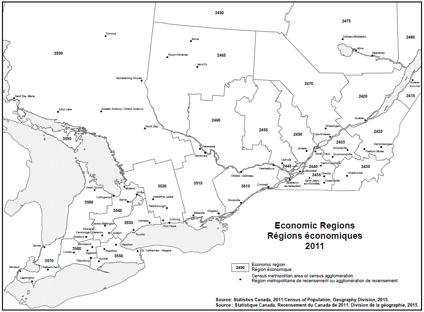
Geographical map of the 2011 Eastern Economic regions – map 2 of 2. See the table below for more detail on the names of the Economic regions, Census metropolitan areas (CMAs), and Census agglomerations (CAs) by province.
| Economic Region | CMA/CA |
|---|---|
| Bas-Saint-Laurent (2415) | Rivière-du-Loup |
| Capitale-Nationale (2420) | Québec |
| Chaudière-Appalaches (2425) | Saint-Georges Thetford Mines |
| Estrie (2430) | Sherbrooke |
| Centre-du-Québec (2433) | Drummondville Victoriaville |
| Montérégie (2435) | Cowansville Granby Saint-Hyacinthe Saint-Jean-sur-Richelieu Salaberry–de–Valleyfield Sorel-Tracy |
| Montréal (2440) | Montréal |
| Laval (2445) | Note ...: not applicable |
| Lanaudière (2450) | Joliette |
| Laurentides (2455) | Lachute |
| Outaouais (2460) | Note ...: not applicable |
| Abitibi-Témiscamingue (2465) | Amos Rouyn-Noranda Val-d'Or |
| Mauricie (2470) | Shawinigan Trois-Rivières |
| Saguenay–Lac-Saint-Jean (2475) | Alma Dolbeau-Mistassini Saguenay |
| Côte-Nord (2480) | Note ...: not applicable |
| Nord-du-Québec (2490) | Note ...: not applicable |
| Economic Region | CMA/CA |
|---|---|
| Ottawa (3510) | Brockville Cornwall Hawkesbury Ottawa–Gatineau |
| Kingston–Pembroke (3515) | Belleville Kingston Pembroke Petawawa |
| Muskoka–Kawarthas (3520) | Cobourg Kawartha Lakes Peterborough Port Hope |
| Toronto (3530) | Oshawa Toronto |
| Kitchener–Waterloo–Barrie (3540) | Barrie Centre Wellington Collingwood Guelph Kitchener–Cambridge–Waterloo Midland Orillia |
| Hamilton–Niagara Peninsula (3550) | Brantford Hamilton Norfolk St. Catharines–Niagara |
| London (3560) | Ingersoll London Tillsonburg Woodstock |
| Windsor–Sarnia (3570) | Chatham-Kent Leamington Sarnia Windsor |
| Stratford–Bruce Peninsula (3580) | Owen Sound Stratford |
| Northeast (3590) | Elliot Lake Greater Sudbury North Bay Sault Ste. Marie Temiskaming Shores Timmins |
Note: ... not applicable for this specific location.
Source: 2011 Census of Canada. Produced by the Geography Division, Statistics Canada, 2015.