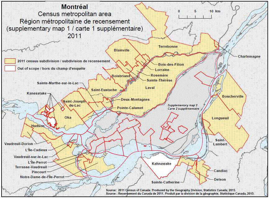
Geographical map of the 2011 Census metropolitan area of Montréal, Quebec – map 2 of 3. The following Census subdivisions and Out of scope areas are listed within this region:
Census subdivisions: Blainville, Boisbriand, Bois-des-Filion, Boucherville, Candiac, Charlemagne, Delson, Deux-Montagnes, Hudson, Laval, L’Île-Cadieux, L’Île-Perrot, Longueuil, Lorraine, Notre-Dame-de-l’Île-Perrot, Oka, Pincourt, Pointe-Calumet, Rosemère, Sainte-Catherine, Sainte-Marthe-sur-le-Lac, Sainte-Thérèse, Saint-Eustache, Saint-Joseph-du-Lac, Saint-Lambert, Terrasse-Vaudreuil, Terrebonne, Vaudreuil-Dorion, Vaudreuil-sur-le-Lac.
Out of scope areas: Kahnawake, Kanesatake.
Source:2011 Census of Canada. Produced by the Geography Division, Statistics Canada, 2015.