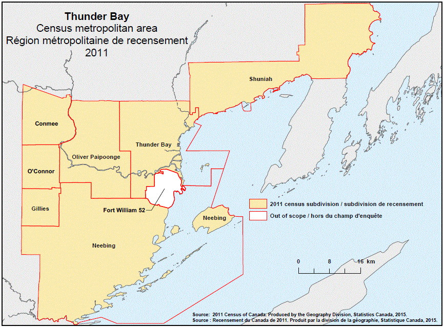
Geographical map of the 2011 Census metropolitan area of Thunder Bay, Ontario. The following Census subdivisions and Out of scope area are listed within this region:
Census subdivisions: Conmee, Gillies, Neebing, O’Connor, Oliver Paipoonge, Shuniah, Thunder Bay.
Out of scope area: Fort William 52.
Source:2011 Census of Canada. Produced by the Geography Division, Statistics Canada, 2015.