
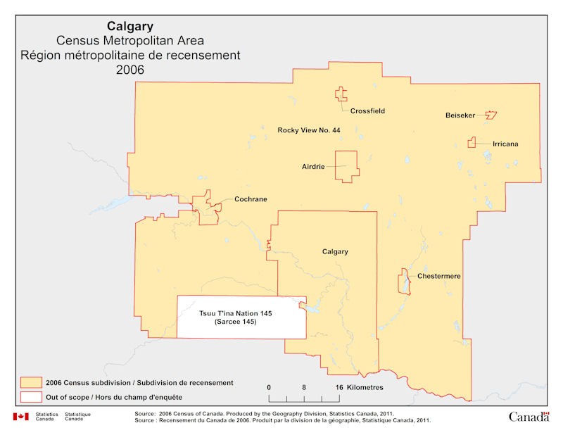
Geographical map of 2006 Census Metropolitan Area of Calgary, Alberta. The following Census subdivisions and Out of scope are listed within this region:
Census subdivisions: Airdrie, Beiseker, Calgary, Chestermere, Cochrane, Crossfield, Irricana, Rocky View No. 44.
Out of scope: Sarcee 145 (Tsuu T'ina Nation 145).
Source: 2006 Census of Canada. Produced by the Geography Division, Statistics Canada, 2011.