
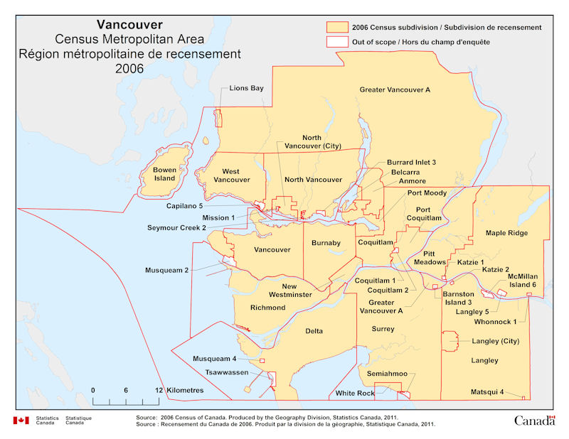
Geographical map of 2006 Census Metropolitan Area of Vancouver, British Columbia. The following Census subdivisions and Out of scope are listed within this region:
Census subdivisions: Anmore, Belcarra, Bowen Island, Burnaby, Coquitlam, Delta, Greater Vancouver A, Langley, Lions Bay, Maple Ridge, New Westminster, North Vancouver, Pitt Meadows, Port Coquitlam, Port Moody, Richmond, Surrey, Vancouver, West Vancouver, White Rock.
Out of scope: Becher Bay 1, Cole Bay 3, East Saanich 2, Esquimalt (R), New Songhees 1A, South Saanich 1, Sooke 1 (T’Sou-ke 1), Sooke 2 (T’Sou-ke 2), Union Bay 4.
Source: 2006 Census of Canada. Produced by the Geography Division, Statistics Canada, 2011.