
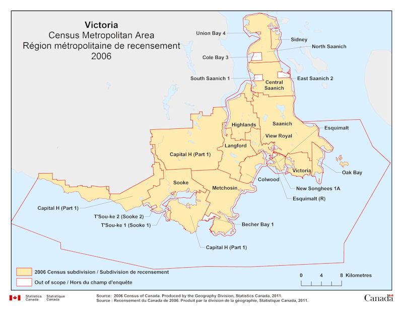
Geographical map of 2006 Census Metropolitan Area of Victoria, British Columbia. The following Census subdivisions and Out of scope are listed within this region:
Census subdivisions: Capital H (Part 1), Central Saanich, Colwood, Esquimalt, Highlands, Langford, Metchosin, North Saanich, Oak Bay, Saanich, Sidney, Sooke, Victoria, View Royal.
Out of scope: Becher Bay 1, Cole Bay 3, East Saanich 2, Esquimalt (R), New Songhees 1A, South Saanich 1, Sooke 1 (T’Sou-ke 1), Sooke 2 (T’Sou-ke 2), Union Bay 4.
Source: 2006 Census of Canada. Produced by the Geography Division, Statistics Canada, 2011.