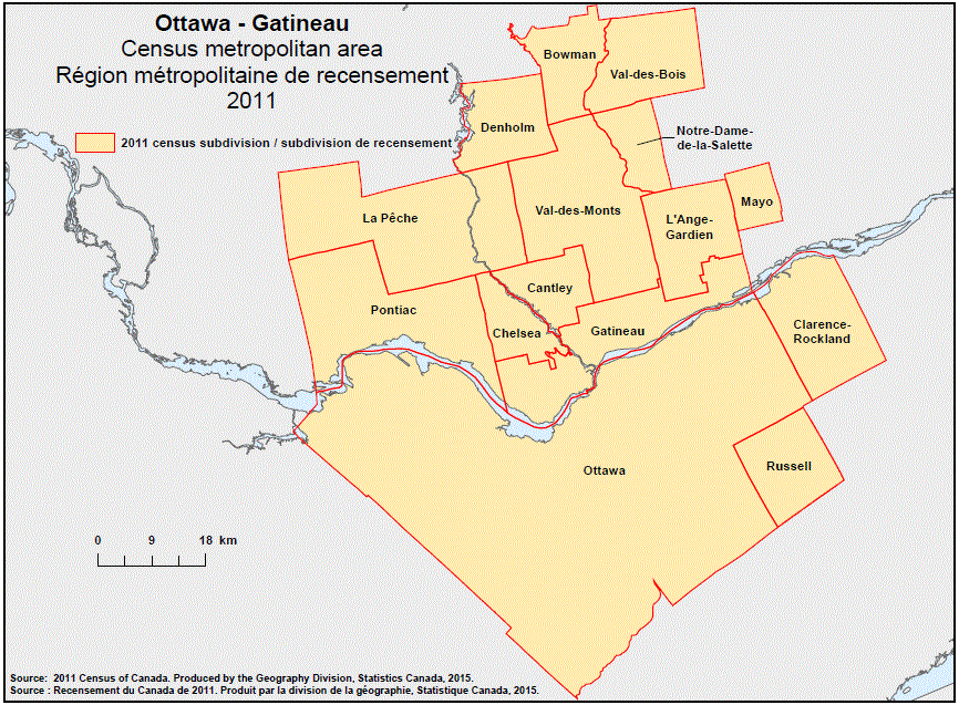
Geographical map of the 2011 Census metropolitan area of Ottawa–Gatineau, Ontario. The following Census subdivisions are listed within this region: Bowman, Cantley, Chelsea, Clarence-Rockland, Denholm, Gatineau, La Pêche, L’Ange-Gardien, Mayo, Notre-Dame-de-la-Salette, Ottawa, Pontiac, Russell, Val-des-Bois, Val-des-Monts.
Source:2011 Census of Canada. Produced by the Geography Division, Statistics Canada, 2015.