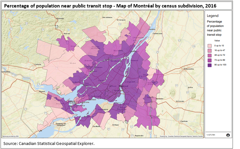
Map 3
Percentage of population near public transit stop - Map of Montréal by census subdivision, 2016

Map description
The title of the map is "Percentage of population near public transit stop - Map of Montréal by census subdivision, 2016"
This is a map showing the percentage of the population living near a public transit stop in 2016 by Census subdivision for Montreal.
Census subdivisions are outlined with a thin black line.
The legend shows a range of colours for percentage values:
0 up to 15 in light pink
16 up to 47 in medium light pink
48 up to 72 in medium pink
73 up to 89 in medium dark pink
90 up to 100 in dark pink
Source: Canadian Statistical Geospatial Explorer.
- Date modified: