Map 1
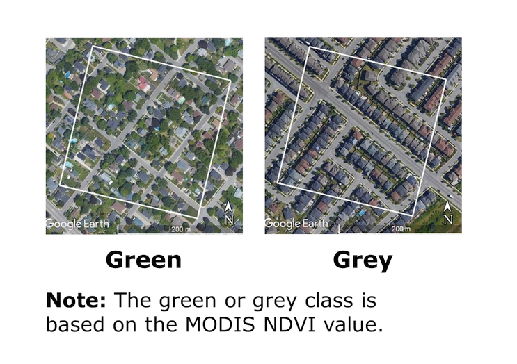
Examples of urban pixels classed as green or grey

Map description
The title of the map is "Examples of urban pixels classed as green or grey"
The purpose of this image is to visually display the difference between a green MODIS pixel and a grey MODIS pixel. The green or grey class is based on the MODIS NDVI value.
The MODIS pixels are represented by a box with a white outline and are overlaid on high resolution aerial imagery provided by Google to visualize what is present on the ground. The image compares two MODIS pixels. The first pixel (left) is classified as green and the second (right) is classified as grey.
The pixel on the left represents a residential area with large lots, trees, grass, houses and roads and is classed as green because its MODIS NDVI value is greater than or equal to 0.5. The pixel on the right represents a residential area with smaller lots, less trees and grass, and more houses and roads compared to the pixel on the right, and is classed as grey because its MODIS NDVI value is less than 0.5.
- Date modified: