
Red River flooding

Archived Content
Information identified as archived is provided for reference, research or recordkeeping purposes. It is not subject to the Government of Canada Web Standards and has not been altered or updated since it was archived. Please "contact us" to request a format other than those available.
Related information
The Red River, spring and flooding are nearly synonymous, with the most recent major floods occurring in 1997, 2009 and 2011. Slow and small most of the year, the Red River meanders north across a vast agricultural plain 64 km to 80 km wide and about 530 km long from its origin on the Minnesota–North Dakota border south of Fargo to its delta known as the Netley Marsh at the southern tip of Lake Winnipeg.
The Red River's watershed encompasses about 290,000 km2, including the Assiniboine River basin (163,000 km2), which joins the Red River at Winnipeg. About 16% of the Red River basin, excluding the Assiniboine basin, is located in Canada; the remainder is within North Dakota, Minnesota and South Dakota. The river falls just 70 m along its entire length of some 880 km. In Manitoba, the river has an average valley gradient of 0.0001.
Because of this flatness, high water has nowhere to go except to overflow the river's shallow banks and spread out across the plain until it resembles a vast, shallow lake. This flooding can have a significant impact on agricultural areas.
In 2009, 1,300 hectares of agricultural land was inundated by the end of March. After reaching 46,800 hectares on April 14, the flooding continued, peaking at 86,400 hectares on April 24. The first area affected by the flood on March 31 was still under water on May 5, indicating that the flooded area did not move from one region to another, but only increased in size. Regions around the municipality of Emerson in southern Manitoba were submerged for at least 36 consecutive days.
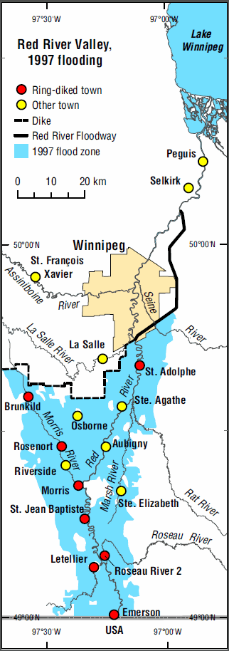
In 2009, it was estimated that 235 farmers were affected by the flood. The 1997 flooding, by comparison, covered 141,900 hectares of cultivated land and affected close to 350 farmers.
Map 15.4 Red River Valley, 1997 flooding
Source: Statistics Canada, Geography Division.
- Date modified: