

Canada’s youngest territory and youngest province, close geographically to one another, are about to hit milestones on back-to-back days.
March 31 is the 75th anniversary of the day Newfoundland entered Confederation as Canada’s 10th province in 1949 (Labrador was formally added to the name in 2001), while April 1 marks 25 years to the day Nunavut became the third territory in 1999, after its separation from the Northwest Territories.
What better time to have a look a key facts and figures!
Geography and population
Nunavut, which means “our land” in the Inuktitut language, stretches north of the Arctic Circle and covers over 1.8 million square kilometres, or about one-fifth (20.9%) of Canada’s land mass of nearly 8.8 million square kilometres.
The 2021 Census counted 36,858 people living in Nunavut, 85.8% of whom were Indigenous. Nunavut’s population is up from 26,745 in 2001, the first census count taken of the new territory.
The population of Newfoundland and Labrador was 510,550 in 2021. In 1951, when the census first counted Canada’s newest province, its population was 361,416.
While the population of Newfoundland and Labrador is about 13 times that of Nunavut, its land area is about five times smaller, covering 358,170 square kilometres, making it the least densely populated province in Canada.
According to the latest population estimates, Newfoundland and Labrador had 540,552 residents on January 1, 2024, while Nunavut had 40,721.
East and north records…and a shared border
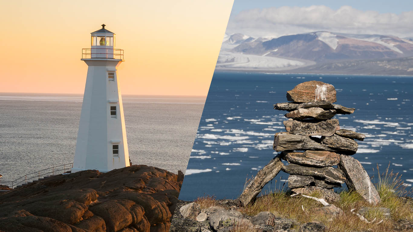
The easternmost point of Canada and North America (excluding Greenland), Cape Spear, is located on Newfoundland and Labrador’s Avalon Peninsula, near the capital city of St. John’s. The second lighthouse ever built in Newfoundland was at Cape Spear, in 1836. More than a century later, in 1955, it was replaced by a new lighthouse, known today as the Cape Spear Lighthouse and the oldest surviving lighthouse in Newfoundland and Labrador.
Nunavut has the most northerly, permanently inhabited location in the world—Alert, a Canadian Forces station on the northern tip of Ellesmere Island, 817 kilometres from the North Pole.
Here’s a fun fact—there is only one land border between Nunavut and Newfoundland and Labrador. It’s on Killiniq Island, an uninhabited island just north of mainland Quebec and Labrador. The Nunavut side is 229.4 square kilometres, just over 6.6 times the 34.5 square kilometres on the Labrador side.
Economic activity
Newfoundland and Labrador contributed $40.7 billion to Canada’s gross domestic product of $2.8 trillion in 2022, while Nunavut contributed $4.8 billion (expenditure-based, in current prices). The mining, quarrying, and oil and gas extraction sector represented the largest share of both economies (31.6% and 43.9%).
Exports
The total domestic export value of international merchandise trade from Newfoundland and Labrador was $12.3 billion in 2023, down 22.1% from 2022, while Nunavut’s export value increased 36.4% to $2.0 billion over the same period.
Learn more
For more about the history and symbols of the provinces and territories, visit Canadian Heritage.

StatsCAN app
Did you know you can read StatsCAN Plus articles and more on the StatsCAN app? If you’re already using the app, let us know what you think by leaving a review in the App Store and Google Play.
Contact information
For more information, contact the Statistical Information Service (toll-free 1-800-263-1136; 514-283-8300; infostats@statcan.gc.ca) or Media Relations (statcan.mediahotline-ligneinfomedias.statcan@statcan.gc.ca).