
Lake Erie Lowland

Archived Content
Information identified as archived is provided for reference, research or recordkeeping purposes. It is not subject to the Government of Canada Web Standards and has not been altered or updated since it was archived. Please "contact us" to request a format other than those available.
Related information
In 2006, Canada's most populous ecoregion was the Lake Erie Lowland. It extends from Toronto in the east to Windsor in the west, and south to Point Pelee, which is the most southerly point of mainland Canada. Other population centres in the ecoregion include Hamilton, St. Catherines–Niagara and London.
In 2006, the Lake Erie Lowland was home to 23.1% of Canada's population. The ecoregion's population has been steadily growing, from 4.5 million in 1971 to nearly 7.3 million in 2006—an increase of 61.6%. After the Lower Mainland ecoregion of British Columbia, it was the most densely populated ecoregion in Canada in 2006, with 305 people per km2.
Its southern location gives the Lake Erie Lowland ecoregion one of the most temperate climates: summers are typically warm and humid, while winters are mild. In 2006, annual and perennial cropland covered 71.1% of its land area; forests, 12.4% and developed land, 10.8%.
Map 15.3 Lake Erie Lowland ecoregion, Ontario
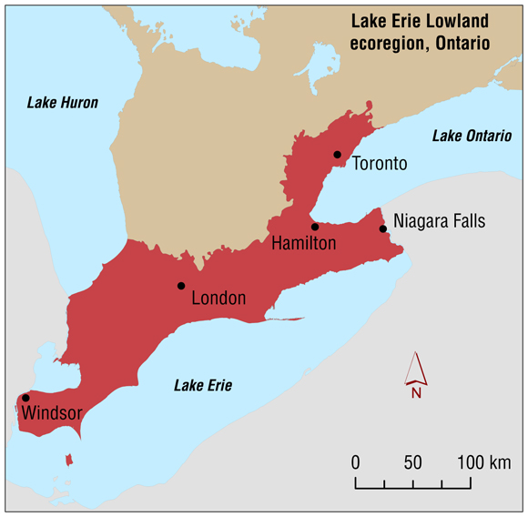
Source: Statistics Canada, Geography Division.
- Date modified: